ATTACHMENTS
Paper
General Meeting
Wednesday 13 November 2013
Roma Administration Centre
NOTICE
OF MEETING
Date:
8 November 2013
Mayor: Councillor
R S Loughnan
Deputy Mayor: Councillor
W S Wason
Councillors: Councillor
J L Chambers
Councillor
R J Denton
Councillor
P J Flynn
Councillor
W M Newman
Councillor
C J O’Neil
Councillor
M L Price
Councillor
D J Schefe
Chief Executive Officer: Ms
Julie Reitano
Senior Management: Mr
Michael Parker (Acting Director Infrastructure Services)
Mr
Rob Hayward (Director Development, Facilities & Environmental Services)
Officers: Ms
Jane Frith (Coordinator Corporate Communications)
Please find attached agenda for the General Meeting to be held at the Roma Administration Centre on November 13, 2013 at
9.00am.

Julie Reitano
Chief Executive Officer
Maranoa Regional Council
General Meeting - 13 November 2013
TABLE OF CONTENTS
Reports
10.2 Request
for a Contribution to Headstone Repairs - Roma Monumental Cemetery
Attachment
1: Barbara Kunde - Quote to Rectify
Damages to Graves at Roma Monumental Cemetery - Cormie McDougall & William
McDougall - 12/09/2013..... 4
Attachment 2: Jane Wilson - Contribution to repairs to grave - Roma
Monumental Cemetery - Betty Wilson.......................................................................................... 7
10.3 2014
Council Meeting Schedule
Attachment
: Draft Council Meeting Schedule 2014................................................ 11
10.4 Request
for Donation
Attachment
: Letter of Request - Wallumbilla
State School..................................... 12
11.1 Opportunity
to rename Surat Racecourse Reserve
Attachment
: Opportunity to rename Surat
Recreation Reserve letter_7 June 2013 13
11.3 Customer
Service Charter
Attachment
: Customer Service Charter Proof
November 2013............................. 14
12.1 Gravel
upgrade - Property Access - Carnarvon Highway
Attachment
1: Email from Justin Higgins - Request
for Gravel and Road Name Sign 16
Attachment 2: Acknowledgement Letter to Justin Higgins Re Request
for Gravel Seal - Nareeton Rd........................................................................................ 19
Attachment 3: Letter re Reply to the Request for the Extension of
Hickey's Road... 20
12.2 Request
for Dust Seal - Two Mile Road
Attachment
1: Ian Forbes Request for Dust Seal - Two
Mile Rd, Roma................... 22
Attachment 2: Acknowledgement Letter to Ian Forbes Re Request for
Dust Seal - Two Mile Rd............................................................................................................. 23
12.3 Reformation
and Gravel Upgrade - Donnybrook Road
Attachment
1: Request Reforming & Gravel Upgrade
- Donnybrook Road - Helen Allen 24
Attachment 2: Acknowledgement Letter to Helen Allen Re Request for
Gravel pavement - Donnybrook Road............................................................................... 27
12.4 Adoption
of Quality Management Policy
Attachment
1: Quality Management Policy Statement
V4_signed (current)............. 28
Attachment 2: Quality Management Policy - [Draft]V0.2........................................... 29
12.5 Adoption
of Environmental Management Policy
Attachment
: Environmental Management Policy -
[Draft_PDF]V0.2..................... 36
13.1 Assessable
building works - Oversized Shed in the Residential zone (2013/18758)
Attachment
: Application documents........................................................................ 43
13.2 Material
Change of Use - Accommodation Units (2 Units) (File:2013/18622)
Attachment
1: Body of Report.................................................................................... 48
Attachment 2: Development Plans............................................................................. 61
Attachment 3: Adopted Infrastructure Charges Notice.............................................. 64
13.3 Permission
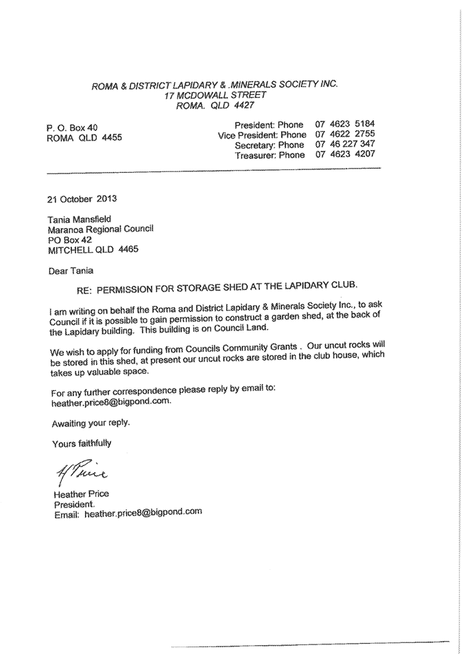
for Construction of a Garden Shed
Attachment
: Letter - Roma & District
Lapidary and Minerals Society - Construction of a Garden Shed....................................................................................... 67
13.4 UBIMET
Severe Weather Detection System
Attachment
: UBIMET Lightning Detection System................................................. 68
13.5 Material
Change of Use - "High Impact Industy" (Waste Storage Pond) and
Environmentally Relevant Activity 56 - Regulated Waste Storage (File:
2013/18600)
Attachment
1: Body of Report.................................................................................... 78
Attachment 2: DTMR Amended Response................................................................ 99
Attachment 3: EHP Response.................................................................................. 107
13.6 Development
Application for Material Change of Use - "Accommodation Units" (18
Units) (2013/18702)
Attachment
1: Body of Report.................................................................................. 119
Attachment 2: Development Plans........................................................................... 134
Attachment 3: Adopted Infrastructure Charges Notice............................................ 167
13.8 Sponsorship
Opportunity - Surat Basin Energy & Mining Expo Industry Forum - 17 June
2014
Attachment
: 2014 Sponsorship Proposal.............................................................. 171
13.9 Horizon
Housing Company Regional Advisory Committee (Maranoa)
Attachment
1: Horizon Housing Company_MRC MOU_
General operations........ 174
Attachment 2: Action Sheet - General Meeting - 25 July 2012 - 15.3 -
Memorandum of Understanding between Council and Horizon Housing Company... 194
Attachment 3: Horizon Housing Company Regional Advisory Committee -
Draft Terms of Reference......................................................................................... 195
Councillor Business
22.1 Review
of and Suggested Improvements to the Provision of Public Toilets in Surat
Attachment
: Images - Toilets in Surat -
Attachment 1.......................................... 198
Closure
|
Attachment 1
|
Barbara Kunde - Quote to Rectify Damages to Graves
at Roma Monumental Cemetery - Cormie McDougall & William McDougall -
12/09/2013
|


|
Attachment
2
|
Jane Wilson - Contribution to repairs to grave -
Roma Monumental Cemetery - Betty Wilson
|


|
Attachment 1
|
Draft Council Meeting Schedule 2014
|

|
Attachment 1
|
Letter of Request - Wallumbilla State School
|

|
Attachment 1
|
Opportunity to rename Surat Recreation Reserve
letter_7 June 2013
|
7
June 2013
CEO
Julie
Reitano
Maranoa
Regional Council
PO
Box 42
Mitchell
Qld 4465
Dear
Ms Reitano,
I
have recently been approached by Council staff to ask if the User Group at the
Surat Racecourse Reserve refer to this area by the same name as Council, due to
Council staff designing and constructing a sign for the entrance to this area.
After a discussion with the executive of the groups that use this area, I
responded that we would like to go to the community to ask their thoughts
regarding an official name for the Surat Racecourse Reserve.
I
am aware that Council are having a sign designed to be placed at the front
entrance and this would be good timing to suggest a name change to this area
for Council consideration, if the community so desire. Executive members of the
User Group agree and would like to gauge the level of support for a name change
with the local residents.
Can
you please advise if Council support this idea and if so, can Council staff
assist the User Group to send a survey out to community members. The names we
would like to survey are Surat Racecourse Reserve and Warroo Sporting Complex,
with an opportunity for residents to also include their own preference.
If
you need to speak with me you can ring me on 0428 569394 or email suratponews@bigpond.com.au
Regards,
Graham
Hancock,
On
behalf of Surat Racecourse Reserve User Group
|
Attachment 1
|
Customer Service Charter Proof November 2013
|


|
Attachment 1
|
Email from Justin Higgins - Request for Gravel and
Road Name Sign
|


|
Attachment
2
|
Acknowledgement Letter to Justin Higgins Re Request for
Gravel Seal - Nareeton Rd
|
Our Ref: D13/36491; D13/46608
Enquiries: Clara Aitken
Phone: 4624 0712 (Direct) or
1300
007 662 (via Customer Service)
Office: Infrastructure Services
4 October 2013
Justin Higgins
Via E-mail: justin.higgins@elders.com.au
Dear Justin
Re: Request for Gravel pavement to Nareeton Road
Thank you for your
correspondence addressed to Councillor Scott Wason dated 23rd July
2013, outlining your request for Council to provide a gravel pavement to
Nareeton Road.
I have undertaken
an initial review of your concerns raised and have allocated this matter to
Kylie Fleischfresser (Coordinator Infrastructure Planning) for further
investigation. Following this investigation, a report will go to the Council
meeting of 23 October 2013 for resolution.
Following this
meeting I will advise you of the outcome.
Again, thank you
for bringing this matter to the attention of Councillor Wason; I will continue
to keep Councillor Wason informed as the matter progresses.
Please do not hesitate to contact Clara Aitken of my office
on (07) 4624 0712, or by email – clara.aitken@maranoa.qld.gov.au, if you have any further questions
or concerns with progression of your request.
Yours faithfully
Kym Downey
Manager –
Infrastructure Planning & Design
|
Attachment
3
|
Letter re Reply to the Request for the Extension of
Hickey's Road
|
14 November 2007
Mr
R Neven
“Donegal”
MS
619
ROMA
QLD 4455
Dear
Robert
Re: Requesting
access to Lot 31 on SP178386
With
reference to your letter dated 15 October 2007, which was tabled at the Council
Meeting held on Friday 9 November 2007, I advise that the following motion was
carried:
‘that the application for access,
to Lot 31 on SP178386, through the extension of Hickeys Road be granted with
all costs to be borne by the applicant.’
A
joint on-site inspection, with Council’s Overseer Noel Kerr, is to be conducted
prior to the commencement of any works associated with the new access. The
inspection can be arrangement by contacting Noel on 0427 374 312.
Yours
faithfully
D
M Oates
Acting
Chief Executive Officer
Enquiries
to: Noel Kerr
|
Attachment 1
|
Ian Forbes Request for Dust Seal - Two Mile Rd, Roma
|
From:Kym
Downey[EX:/O=ROMA REGIONAL COUNCIL/OU=EXCHANGE ADMINISTRATIVE GROUP
(FYDIBOHF23SPDLT)/CN=RECIPIENTS/CN=KYM.DOWNEY]
To:Clara
Aitken[EX:/O=ROMA REGIONAL COUNCIL/OU=EXCHANGE ADMINISTRATIVE GROUP
(FYDIBOHF23SPDLT)/CN=RECIPIENTS/CN=Clara.aitken]
To:Kylie
Fleischfresser[EX:/O=ROMA REGIONAL COUNCIL/OU=EXCHANGE ADMINISTRATIVE GROUP
(FYDIBOHF23SPDLT)/CN=RECIPIENTS/CN=Kylie.fleischfresser]
Received-Date:20131025
Received-Time:3:23:47
AM
Sent-Date:20131025
Sent-Time:3:23:46
AM
Subject:Dust
Seal Request
Kylie,
Clara
Ian
Forbes (Ph: 0427 626 616) has approached Michael about getting a dust seal in
front of his residence at 122 Two Mile Road.
Michael
advised Mr Forbes of our policy and told him that we would investigate and do a
report to council.
Could
you please action this as per our standard process – commence the process by
registering this email in TRIM
Thanks
Kym
Kym
Downey
Manager
- Infrastructure Planning & Design,
Infrastructure
Planning & Design
Ext:
6714 D: (07) 4624 0714 M: (04) 2937 9631 F: (07) 4624 6990
Skype:
mrc.kym.downey
|
Attachment
2
|
Acknowledgement Letter to Ian Forbes Re Request for
Dust Seal - Two Mile Rd
|
Our Ref: D13/51294;D13/51302
Enquiries: Clara Aitken
Phone: 4624 0712 (Direct) or
1300
007 662 (via Customer Service)
Office: Infrastructure Services
25 October 2013
Ian Forbes
122 Two Mile Road
ROMA QLD 4455
Dear Ian
Re: Request for Dust Seal – Two Mile Road, Roma
I am writing by
way of acknowledgement to your request for a dust seal in front of your
property on Two Mile Road, Roma.
Thank you for taking
the time recently to discuss this matter with Council’s Acting Director –
Infrastructure Services, Michael Parker. I understand that he has advised you
on Council’s Dust Seal policy and process to formally table your request to
Council.
I have undertaken
an initial review of your request and have allocated this matter to Kylie
Fleischfresser – Coordinator Infrastructure Planning, for further
investigation. Following this investigation, a report will go to the Council
meeting of 13 November 2013 for resolution.
Following this
meeting I will advise you of the outcome.
Again, thank you
for bringing this matter to the attention of Council; I will continue to keep
you informed through to finalisation of your request.
Please do not
hesitate to contact Clara Aitken of my office on (07) 4624 0712, or by email – clara.aitken@maranoa.qld.gov.au, if you have any questions or concerns
with progression of this matter.
Yours faithfully
Kym Downey
Manager –
Infrastructure Planning & Design
|
Attachment 1
|
Request Reforming & Gravel Upgrade - Donnybrook
Road - Helen Allen
|


|
Attachment
2
|
Acknowledgement Letter to Helen Allen Re Request for
Gravel pavement - Donnybrook Road
|
Our Ref: D13/48375; D13/48870
Enquiries: Clara Aitken
Phone: 4624 0712 (Direct) or
1300
007 662 (via Customer Service)
Office: Infrastructure Services
15 October 2013
Mrs Helen Allen
“Mountain Cottage”
ROMA QLD 4455
Dear Mrs Allen
Re: Request for Gravel pavement to Donnybrook Road
Thank you for your
correspondence to Council’s Acting Director – Infrastructure Services, Michael
Parker, dated 10 October 2013, in which you request that Council provide gravel
pavement to 2.6 kilometres section to Donnybrook Road.
I have undertaken
an initial review of your concerns raised and have allocated this matter to
Kylie Fleischfresser (Coordinator Infrastructure Planning) for further
investigation. Following this investigation, a report will go to the Council
meeting of 13 November 2013 for resolution.
Following this
meeting I will advise you of the outcome.
Again, thank you
for bringing this matter to the attention of Council. Please do not hesitate to
contact Clara Aitken of my office on (07) 4624 0712, or by email – clara.aitken@maranoa.qld.gov.au, if you have any further questions or
concerns with progression of your request.
Yours faithfully
Kym Downey
Manager –
Infrastructure Planning & Design
|
Attachment 1
|
Quality Management Policy Statement V4_signed
(current)
|

|
Attachment
2
|
Quality Management Policy - [Draft]V0.2
|


|
Attachment 1
|
Environmental Management Policy - [Draft_PDF]V0.2
|


|
Attachment 1
|
Application documents
|


|
Attachment 1
|
Application documents
|


|
Attachment
1
|
Body of Report
|
1.0 Background Information
The application seeks approval
for a material change of use for “Accommodation Units” (two dwelling units) at
30 Saunders Street, Roma, described as Lot 1 on RP125322.
The development comprises two
detached units each with two bedrooms and a single bathroom.
The development site is located
within the Residential Zone and is surrounded by existing residential land
uses. The site comprises an area of 656m2 and is currently occupied
by an outbuilding.


Figure 1 - Locality Plan

Figure 2 – View of site from Saunders Street
2.0 Definition of Use
and Assessment Status
The proposed use is defined as "Accommodation
Units" in the Roma Town Planning Scheme 2006, which is described as
follows:
“Accommodation Units”
means any premises comprising an integrated development of dwelling units and/r
rooming units. The term includes multiple dwelling units, retirement villages
and apartment houses.
The application is subject to
Impact Assessment against the relevant provisions of the planning scheme.
Public Notification was carried out from 27 August 2013 to 17 September
2013. No submissions were received during this period.
The development proposal does not
trigger assessment by any external agencies.
3.0 Assessment Against the Planning Scheme
Desired Environmental Outcomes
The Desired Environmental
Outcomes (DEOs) are based on ecological sustainability established by Sustainable
Planning Act 2009, and are the basis for the measures of the planning
scheme. Compliance with the DEOs is examined below:
(a) Environment
(i) The areas of high scenic amenity,
remnant vegetation, wetlands, fauna habitats and wildlife corridors and
regionally significant open space in the town are protected.
The site is situated within a
developed urban area and will not result in the removal of any significant
vegetation, or impact on environmentally significant areas, including wetlands,
habitats, corridors and open spaces.
(ii) Places, areas or sites identified as being
susceptible to land degradation, including contamination, erosion, salinity and
landslip, are protected and further degradation is minimised.
The subject site is not
identified as being susceptible to land degradation. Nevertheless the proposed
development does not involve any works which may result in such
issues.
(iii) Ecological sustainability is achieved by maintaining
and improving biodiversity, water and air quality.
The proposal is for a residential
use in a developed urban area. The development will not compromise
biodiversity, water or air quality.
(iv) Places of historical and indigenous cultural heritage and
social significance are protected, maintained and enhanced.
The subject site is not
identified as being in proximity to, or a place of, historical, cultural or
social significance.
(b) Economic
(i) Business and
commercial development shall be located within the Commercial Zone to promote
and strengthen the existing central Business District.
(ii) The Central Business
District (CBD) or inner core of the Commercial Zone is intended to contain the
more intensive commercial uses. Entertainment facilities and tourist
accommodation will also be favoured within and adjacent to the CBD to provide a
central focus of activity and promote vitality after office hours.
The proposal
is for residential development in a residential area and will not compromise
the location of business and commercial development with the Commercial Zone
and CBD.
(iii) Beautification and improved
parking facilities will enhance the efficiency, attractions and vitality of the
Town CBD.
The
proposal is for residential development that is not located in proximity to the
Town CBD. The proposed use will not adversely impact on the efficiency,
attractions or vitality of the commercial area.
(iv) Tourism will be promoted with
significant economic and social benefits to the town as a regional centre with
close association with the oil and gas industry and the proximity of the
Carnarvon National Park.
The proposal is for residential
development within the Residential Zone and will not adversely impact on
tourism in the region.
(v) Industry, business and employment
opportunities are improved and appropriately located to service the community
and region, and encourage economic activity within the local area.
The development will support
industry, business and employment opportunities in the local area by increasing
the range of accommodation available within Roma.
(c) Community Well-Being & Lifestyle
(i) Convenient access to roads and services
is achieved through well located land uses and the efficient use and timely provision
of infrastructure such as water, sewerage and roads walkways and cycling
facilities.
The development site is located
within an established residential area that provides convenient access to
infrastructure and services.
(ii) Infrastructure networks such as road and rail,
water cycle and electricity infrastructure are protected from encroachment by
sensitive land uses which may adversely affect or limit the normal operation of
that infrastructure.
The development site is not
located in proximity to major water cycle, rail or electricity
infrastructure. The development is appropriately located within a
residential area and will not adversely impact on the operation of the local
road network.
(iii) Rural residential and urban residential development
occurs in distinct localities that provide a sense of community, amenity,
services, and a safe, affordable living environment, whilst maintaining the
rural amenity of the Town Area.
The development site is located
within an established residential area with infrastructure and services
available to provide a suitable living environment for residents of the
dwelling units. The development will contribute to the local streetscape by
providing housing diversity, whilst remaining sensitive to the rural amenity of
the town through a design and use of building materials that are consistent
with the scale, siting and character of the local area. Site landscaping and
will also contribute to the overall amenity of the development and streetscape.
(iv) The adverse effects from natural and other hazards,
including bushfires are minimised.
The site is not identified as
being susceptible to bushfire, flooding or other hazards.
(v) The range of housing types, services and
facilities meets the needs of the community and other uses.
The proposed development will
increase the range of housing types available to the community.
(vi) Community well being is not compromised by
inappropriate development that impacts upon noise levels, traffic volume,
lighting levels, local amenity.
The proposal is for a residential
use within the Residential Zone. The development is consistent with the
existing land uses in the locality and will not have an adverse impact on noise
levels, traffic volume, lighting levels or the local amenity.
Overall Outcomes for Urban Area Code
The Urban Area Code identifies
overall outcomes providing direction about relevant assessment issues.
The overall outcomes are examined below:
(a) Roma is a focus for a range of business,
industrial, tourist, community and recreational activity in the local
government area;
The proposed development will
provide residential accommodation which will support a range of activities in
Roma.
(b) Business and commercial development
is located primarily in the CBD to provide central and accessible services to
the local government area;
The proposal is for a residential
development situated within the Residential Zone. The development does
not involve business or commercial activities.
(c) The residential and heritage
character and amenity of the Urban Area is retained;
The proposed development is
limited to a single storey and 4.3 metres in height. The buildings will be
constructed of “Linea” cladding with a pitched roofline and colorbond roof
sheeting. The development is consistent with the scale and character of
residential land uses in the surrounding area.
(d) Safe and convenient access for
pedestrians and cyclists is maintained and enhanced;
The development is consistent
with the intent of the residential area and will not adversely impact on the
safety and convenience of cyclist or pedestrian movements in the
locality. Vehicle manoeuvring areas will be provided within the
site to ensure vehicles can exit onto the roadway in a forward direction.
(e) Residential (including Rural Residential)
development occurs where there is no adverse impact on Good Quality
Agricultural Land;
The development site is located
within the Roma Town area and is not situated in proximity to Good Quality
Agricultural Land.
(f) Residential development is
buffered from the existing and proposed road and rail corridors to minimise any
detrimental impact;
The development is not located in
proximity to rail corridors. Access to the site will be obtained via a local
access street which is designed to cater for residential land uses.
(g) Residential development
accommodates a range of housing types and allotment sizes, and provides a safe
and pleasant living environment, with adequate access to community services and
is located in the residential preferred areas shown on the Urban Area Maps in
the appendices;
The development site is located
in an established residential area with access to community services. The
development will increase housing diversity in Roma Town.
(h) The expansion of residential
development occurs in areas where it is most cost effective to supply physical
infrastructure, such as water, sewerage, roads and electricity;
The proposed development is
located within an established residential area that has access to
infrastructure necessary to service the proposed use.
(i) Efficient and equitable access to social
infrastructure, such as schools, neighbourhood shopping, community services,
public transport services, and parks are provided in residential areas;
The development site is located
in an established residential area with efficient and equitable access to
social infrastructure.
(j) Industrial development is
located in the Industrial Zone of the town (see maps in appendices);
(k) Impacts of industrial uses are
required to be within acceptable limits and uses are undertaken in sustainable
manner consistent with the amenity and character of the area concerned;
The proposal does not involve
industrial development.
(l) Small scale business,
community and emergency services are provided for the needs of the local
community;
The proposed development does not
involve any business, community or emergency services.
(m) All Areas other than the Commercial Zone
are protected from shopping centre and other forms of commercial development.
The proposal is for a residential
use in the Residential Zone and does not involve commercial development.
Performance Criteria of the
Urban Area Code
The
relevant Performance Criteria of the Code is examined below to provide more
detailed consideration of relevant issues -
|
Performance Criteria
|
Assessment
Responses
|
|
A.
For all of the Town Area
|
|
Infrastructure
PC 1 Electricity
Premises are provided with a supply of electricity
adequate for the activity.
|
The proposed development is
located in an established urban area with access to electrical
infrastructure.
|
|
PC 2 Water supply
Premises are provided with an adequate volume and supply
of water for the activity.
|
The proposed development is
located in an established urban area with reticulated water supply available.
|
|
PC 3 Effluent disposal
To ensure that public health and environmental values are
preserved, all premises provide for the treatment and disposal of effluent
and other waste water.
|
The proposed development is
located in an established urban area with reticulated sewerage available.
|
|
PC 4 Stormwater/Inter-allotment Drainage
Stormwater is collected and discharged so as to:
(a) protect the stability of buildings or the use
adjacent land;
(b) prevent the waterlogging of nearby land;
and
(c) protect and maintain environmental values.
|
Conditions of approval will
require stormwater from the development site to be collected and discharged
to ensure no increase in post-development flows to adjoining properties and
no contamination or silting of waterways.
|
|
PC 5 Vehicle Access
Vehicle access is provided to a standard appropriate for
the use.
|
Access to the site will be
obtained via a sealed vehicle crossover to Saunders Street. This will be
imposed as a condition of approval.
|
|
PC 6 Density
The density of residential activities does not impact
adversely on the residential amenity of the town.
|
Not Applicable – The proposed
development is for Accommodation Units.
|
|
PC 7 Parking and manoeuvring
Vehicle parking and service vehicle provision is adequate
for the use whilst ensuring both safe and functional operation for motorists
and pedestrians.
|
The development incorporates
one undercover car parking space for each unit and a single visitor parking
space. A total of three car parking spaces will be provided on the site.
Vehicle manoeuvring areas will
be provided onsite to allow vehicles to exit onto the roadway in forward
direction.
All access, car parking and
manoeuvring areas will be sealed with an approved impervious surface ensuring
all weather access to the existing road network.
|
|
PC 8 Roads
All weather road access is provided between the premises
and the existing road network.
|
The development proposal does
not involve the creation of new roads. Conditions of approval will require
the construction of a sealed vehicle crossover to the roadway.
|
|
PC 9 State Controlled Roads
State Controlled Roads are maintained and enhanced as a
link between major centres.
|
The development site is located
on a local access street which is designed to cater for residential land
uses. The development is not in proximity to State-controlled roads and will
not impact on their function as a link between major centres.
|
|
PC 10 Development Adjacent to State Controlled
Roads
Development adjacent to State Controlled Roads is located
to ensure safe and efficient use of the highway and maintain the integrity of
the highway as a commuter link.
|
Not Applicable - The
development site is not located adjacent to a State controlled road.
|
|
PC 11 Noise Sensitive Development
Noise sensitive developments (residential, educational and
community) must ensure that road traffic noise levels are appropriately
managed to achieve acceptable levels of amenity.
|
The proposed development is
located on a local residential access street and is surrounded by residential
land uses. The proposal will not be adversely impacted by noise generated
from road traffic.
|
|
PC 12 Development in the Vicinity of Aerodrome
Development
(a) does not adversely affect the
operation of the aerodrome;
(b) is designed and located to
achieve a suitable standard of amenity for the proposed activity; and
(c) does not restrict the future
operational demands of the aerodrome.
|
Not Applicable - The proposed
development is not in the vicinity of the aerodrome.
|
|
PC 13 Development in the Vicinity of Aerodrome
The development of premises does not cause an obstruction
or other potential hazard to aircraft movement associated with the aerodrome
by way of:
(a) the physical intrusion of
buildings or other structures into the Obstacle Limitation Surface;
(b) attracting birds or bats to
the area which could cause or contribute to bird strike hazard;
(c) providing very bright lighting
or lighting similar to aerodrome lighting which can distract or confuse
pilots;
(d) interfering with navigation or
communication facilities;
(e) emissions that may affect
pilot visibility or aircraft operations; or
(f) transient intrusions into the
aerodromes operational space.
|
Not Applicable - The proposed
development is not in the vicinity of the aerodrome.
|
|
PC 14 Gas and Oil Pipelines
Buildings are located at an appropriate distance from
pipelines to ensure community safety and operation of the use is not
compromised.
|
The site is situated in an
established residential area and is located an appropriate distance from gas
and oil pipelines.
|
|
PC 15 Refuse Tips and Effluent Treatment Plants
Premises are located at an appropriate distance from
refuse tips and effluent treatment plants to ensure community safety and
operation of the uses are not compromised.
|
The site is not located in
proximity to refuse tips or effluent treatment plants.
|
|
PC 16 Rail Corridors
Development is at an appropriate distance from the rail
corridor so as not to prejudice safety, speed or intended role of the
existing and proposed rail corridors.
|
The development site is not
located on proximity to rail corridors.
|
|
PC 17 Noise Attenuation
Development adjoining the rail corridor is protected from
the impact of noise.
|
Not Applicable – The site does
not adjoin a rail corridor.
|
|
2. Environment
PC 18 Watercourses
Development ensures the maintenance of riparian areas and
water quality including protection from off-site transfer of sediment.
|
Not Applicable – The site is
not located in proximity to watercourses.
|
|
PC 19 Protected Areas
Development is undertaken to ensure areas of significant
biodiversity and habitat value are protected.
|
Not Applicable – The site is
not located in proximity to areas of significant biodiversity or habitat
value.
|
|
PC 20 Flooding
Premises are designed and located so as:
(a) not to be adversely impacted upon by flooding;
(b) to protect life and property; and
(c) not to have an undesirable impact on the extent and
magnitude of flooding.
|
Not Applicable - The
development site is not identified as being subject to a 1 in 100 year flood
event.
|
|
PC 21 Air Emissions
Air emissions from premises do not cause environmental
harm or nuisance to adjoining properties or sensitive land uses.
|
The proposed development is a
residential use and is not of a nature to cause environmental harm or
nuisance through air emissions.
|
|
PC 22 Noise Emissions
Noise emissions from premises do not cause environmental
harm or nuisance to adjoining properties or sensitive land uses.
|
The development is for a residential
use that is consistent with the intent of the area within which it is
proposed. The development is not anticipated to generate noise levels
in excess of what would normally be expected in a residential area.
|
|
PC 23 Water Quality
The standard of effluent and/or stormwater runoff from
premises ensures the quality of surface water is suitable for:
(a) the biological integrity of aquatic ecosystems;
(b) recreational use;
(c) supply as drinking water after minimal
treatment;
(d) agricultural use; or
industrial use; and
(e) Minimises nuisance or harm to adjoining land
owners
|
The development will
incorporate appropriate stormwater disposal for the proposed use. This
will be imposed as a condition of approval.
|
|
PC 24 Excavation and Filling
Excavation and filling of land ensures:
(a) that both the amenity and
safety of users of the site and adjacent land holdings; and
(b) soil erosion is kept to a
minimum with remedial works.
|
Conditions of approval will
require any excavation and filling of the site to be undertaken in accordance
with Schedule 7: Standards for Construction Activity and the CMDG Design
Guidelines.
|
|
PC 25 Construction Activities
Both erosion control and silt collection measures are
undertaken so as to ensure protection of environmental values during
construction.
|
During construction, soil
erosion and sediment will be managed in accordance with Schedule 7:
“Standards for Construction Activity”. This will be imposed as a condition
of approval.
|
|
PC 26 Bushfire Hazard Area
Development maintains the safety of people and property by
avoiding areas of High or Medium Bushfire hazard or mitigating the risk
through:
(a) the siting of buildings ensuring setbacks from
hazardous vegetation are maximised and elements least susceptible to fire are
sited closest to the bushfire hazard; and
(b) the provision of firebreaks to ensure adequate
setbacks between Buildings, structures and Hazardous vegetation
|
The development site is located
in an urban area and is not identified as a Medium or High Bushfire Hazard
Area.
|
|
PC 27 Character Buildings
Development adjacent to buildings identified as heritage
or character buildings within Schedule 9 incorporates design features,
materials and details that blend with the existing character of the adjoining
buildings and/or place.
|
Not Applicable – The
development is not located near to heritage or character buildings.
|
|
PC 28 Cultural Heritage
The significance of known places of indigenous and/or
cultural heritage value is retained.
|
The development is not located
in proximity to any places of known indigenous or cultural heritage value.
|
|
B. For the Residential Zone
|
|
a) Residential Development –
Dwelling House, Dual occupancy and Accommodation Units
|
|
PC 29 Height
The height of residential buildings is compatible with and
complementary to the character of the urban environment.
|
The proposed development is
limited to a single storey and 4.3 metres in height above ground level. The
scale of the development is consistent with the character of the surrounding
urban area.
|
|
PC 30 Site Coverage and Setbacks
(a) Residential building design and siting maintains the
character of the locality in terms of building bulk.
(b) Residential buildings are located to ensure the local
amenity and streetscape are protected and enhanced.
|
AS 30.1
The building footprint of the
units and carports will occupy 195m2 of the site area, equating to
approximately 30% site coverage. The development is sensitive to the local
character and amenity in this respect.
AS 30.2 – AS 30.4
Not Applicable – The
development is not for dual occupancies.
AS 30.5 - AS 30.7
The proposed units will be
setback 6 metres from the front boundary, a minimum of 3.0 metres from the
side boundaries and 9.0 metres from the rear boundary.
A relaxation of the minimum
setback to the front boundary (7.0 metres) is sought to avoid constructing
over the existing sewerage main traversing the rear of the site. A 6.0 metre
setback to the front boundary is in keeping with existing dwellings in the
area and will not comprise local amenity.
|
|
PC 31 Residential amenity For Dual Occupancies and
Accommodation Units:
The location and design of dual occupancies provides for
adequate privacy, sunlight, ventilation and open space.
|
The proposed units are setback
from site boundaries to ensure adequate sunlight, ventilation and open space
is provided for residents. Privacy fencing will be established between the
units and along the site boundaries to provide private open space for
residents of the units.
|
|
PC 32 Landscaping For Dual Occupancies and
Accommodation Units:
Landscaping on the site should be:
(a) visually pleasing and create an attractive
environment;
(b) located to take account of the direction of the
breezes and sun; and
(c) located to give privacy and buffering from any
potential incompatible uses.
(d) Located to avoid interference with electricity
lines and infrastructure.
|
Landscaping will be established
to a width of 1.5 metres adjacent the front boundary of the site and 0.5
metres width between the driveway and eastern property boundary. A
landscaped area will also be provided adjacent to the vehicle manoeuvring
area at the rear of the site. The private open space areas of each unit will
be grassed.
Site landscaping will
contribute to the overall amenity of the development and local
streetscape.
|
|
a)
Residential Development – Outbuildings
|
|
PC 33 Residential
Outbuildings
Residential amenity is to be
maintained.
|
The development includes a
single carport to cater for each of the units.
The carports comply with the
minimum boundary setbacks and will not be visible from the street frontage.
The proposed outbuildings will not adversely impact the residential amenity
of the area.
|
5.0 Assessment
Summary
Although the proposed development
requires assessment against the Impact Assessable provisions of the planning
scheme, the proposal does not conflict with the intent of the Residential
Zone. The proposal is consistent with the scale and character of
residential development in the local area and will contribute to the range of
housing available in Roma Town.
Subsequent approvals for Building
Works and Plumbing and Drainage Works will be required.
|
Attachment
2
|
Development Plans
|


|
Attachment
3
|
Adopted Infrastructure Charges Notice
|

ADOPTED INFRASTRUCTURE
CHARGES NOTICE
Issued by
Maranoa Regional Council in accordance with:
1. Section 648F of the Sustainable Planning
Act 2009
2. State planning regulatory provision
(adopted charges) 2012
3. Maranoa Regional Council Resolution to
adopt Infrastructure Charges for the Roma Planning Scheme under the State
planning regulatory provision (adopted charges), 2012 – effective 26 September
2012
4. Development Approval 2013/18622 for a
Material Change of Use - “Accommodation Units” situated at 30 Saunders Street,
Roma Qld 4455, and described as Lot 1 on RP125322.
(a) The
amount of the charge:
$9,000.00 is payable as infrastructure charges.
This is based on an adopted charge of $15,000.00 per 2 bedroom dwelling
unit.
A discount of $21,000 is applicable based on the monetary equivalent of
the existing lawful use of the premises.
(b) The
land to which the charge applies:
This charge is levied in respect of a Development Approval for a Material
Change of Use “Accommodation Units”, situated at 30 Saunders Street, Roma
Qld 4455, and described as Lot 1 on RP125322.
(c) The
person to whom the charge must be paid:
Chief Executive Officer,
Maranoa Regional Council
(d) When
the charge is payable:
Prior to construction of the approved development.
(e) If the local government has, under
its adopted infrastructure charges resolution, provided for the charge to
increase, an additional amount, worked out in compliance with section
648D(10)(b) of the Sustainable Planning Act 2009, is payable on the day
the charge is paid:
The Maranoa Regional Council Resolution to adopt Infrastructure Charges
for the Roma Planning Scheme under the State planning regulatory provision
(adopted charges) 2102 – effective 26 September 2012, provides for increases in
charges to be made in accordance Section 7 of that Resolution. The increases
are related to the Consumer Price Index (all Groups) for Brisbane.
ADVICE ABOUT THIS ADOPTED INFRASTRUCTURE CHARGES NOTICE (AICN)
When does
an AICN lapse?
An AICN
lapses if the corresponding development approval or compliance permit stops
having effect.
Negotiated
AICN
A person who
receives an AICN may make a written representation (e.g. a letter, facsimile or
email) about the AICN to the entity that gave the notice (i.e. local government
or a water distributor retailer) (Chapter 8, Part 4 of the Sustainable Planning
Act 2009 (SPA)). If the entity agrees with any of the representations, the
entity will issue a negotiated AICN which replaces the original notice.
SPA also
provides for representations to be made about decision notices under Chapter 6,
Part 8. Where a negotiated decision notice affects the amount of an adopted
infrastructure charge, the local government may issue a new AICN to replace the
original notice (section 364 of the SPA).
A
representation about an AICN or a decision notice must be started during the
period within which the person may make an appeal about the AICN or the
decision notice.
Permissible
change and an AICN
A permissible
change is a minor change to a development approval that would not result in a
substantially different development (section 367 of the SPA). An AICN, or
negotiated AICN, cannot be issued as part of the process for a permissible
change to a development approval. In this regard, a permissible change to a
development approval should not result in a change that warrants a new AICN.
Making an
appeal about an AICN
A person, who
is given an AICN or negotiated AICN and is dissatisfied, may appeal to the
Planning and Environment Court (Court) against the notice, under section 478 of
the SPA. An appeal against an AICN or a negotiated AICN can only be about:
§ whether
a charge in the notice is so unreasonable that no reasonable relevant local
government, state infrastructure provider or coordinating agency could have
imposed it; or
§ an
error in the calculation of the charge.
A person has
20 business days to start an appeal against an AICN or negotiated AICN.
Another way
to appeal against an AICN or negotiated AICN is the Building and Development
Dispute Resolution Committee (Committee). The Committee provides an accessible,
affordable and timely service for members of the public not satisfied with
decisions made by local governments and private certifiers. Errors in the
calculation of the charge can be appealed to the Committee, under section 535
of the SPA.
An appeal
against an AICN or negotiated AICN, to either the Court or the Committees, is
not an appeal against a development application, development approval,
compliance assessment or compliance permit. As such, an appeal does not affect
the period in which the corresponding development approval or compliance permit
takes effect and lapses.
FOR YOUR
REFERENCE:
Extract
from the Sustainable Planning Act 2009- Section 478
478
Appeals about particular charges for infrastructure
(1) This section applies to a person who has been given, and is
dissatisfied with—
(a) an
infrastructure charges notice, regulated infrastructure charges notice, adopted
infrastructure charges notice or regulated State infrastructure charges notice;
or
(b) a negotiated
infrastructure charges notice, negotiated regulated infrastructure charges
notice, negotiated adopted infrastructure charges notice or negotiated
regulated State infrastructure charges notice.
(2) The person may appeal to the court against the notice.
(3) An appeal against a notice mentioned in subsection (1) must be
started within 20 business days after the day the notice is given to the
person.
(4) An appeal under this section may only be about—
(a) whether a
charge in the notice is so unreasonable that no reasonable relevant local government,
State infrastructure provider or coordinating agency could have imposed it; or
(b) an error in
the calculation of the charge.
(5) To remove any doubt, it is declared that an appeal under this
section can not be about the methodology used to establish an adopted
infrastructure charge or the charge in a relevant infrastructure charges
schedule, regulated infrastructure charges schedule or regulated State
infrastructure charges schedule.
|
|
To see details of other sections of the Sustainable
Planning Act 2009, you can go to the legislation section of the
Queensland Government website. The following internet link may assist:
http://www.legislation.qld.gov.au/LEGISLTN/CURRENT/S/SustPlanA09.pdf
|
|
|
Attachment 1
|
Letter - Roma & District Lapidary and Minerals
Society - Construction of a Garden Shed.
|
|
Attachment 1
|
UBIMET Lightning Detection System
|


|
Attachment 1
|
Body of Report
|
Body of Report:
The
application seeks approval for a Material Change of Use for “High Impact
Industry” - Wastewater Pond and Environmentally Relevant Activity 56 –
Regulated Waste Storage on land situated at 1915 Carnarvon Highway, Euthulla.
The
development involves the construction of a single storage pond to receive and
store treated and untreated effluent sourced from the Coal Seam Gas operations
within the region. The facility is intended to operate between the hours of
6:00am to 6:00pm seven days a week and an
anticipated 2 employees will work onsite
It
is expected up to ten deliveries per day with an average daily received volume
of up to 263,000 litres.
Storage
Pond design specifications:
· 5 ha x 1.0m deep
· Total storage capacity 50 Megalitres
· Effluent received at the site will comprise of 60%
untreated and 40% treated.
· Total proposed accepted wastewater per year = 95.995
ML per year
The
subject site is situated at 1915 Carnarvon Highway, Euthulla QLD 4455,
described as Lot 15 on WV1343. The site
is zoned Rural and is primarily used for grazing purposes.


Location
– Google Earth



Extract
from Council GIS system

Map
extracted from report provided by applicant
2.0 Definition
of use and assessment status
The
Bungil Shire Planning Scheme 2006 defines the proposed use as "High
Impact Industry” which is described as follows:
“High Impact Industry” means any activity which is classified by the
Environmental Protection Act 1994 as a level 1 environmentally relevant
activity that has not been devolved to local government, or any activity which
is not classified as level 1 environmentally relevant activity but which:
(i) are likely to result in material environmental harm (as
defined in the Environmental Protection Act 1994), due to the materials or
processes involved of the products or wastes produced,
(ii) are likely to generate noise greater than Labg.T + 5db
(A) at any boundary of the site; or;
(iii) require
a licence under the Building (Flammable and Combustible Liquids) Regulation and
are within 200 metres of land zoned Urban and Rural Residential.
The term includes activities commonly referred to as
noxious, hazardous or offensive industries and salvage yards.
The
application is subject to Impact Assessment against the relevant provisions of
the Bungil Shire Planning Scheme 2006. Ten
submissions were received during the public notification period (11/06/2013 –
03/07/2013).
3.0 Assessment
against the planning scheme
The Desired Environmental Outcomes (DEOs) are based on
ecological sustainability established by Sustainable Planning Act 2009,
and are the basis for the measures of the planning scheme. The DEOs are
examined below:
(a) Environment
(i) The
areas of high scenic amenity, remnant vegetation, wetlands, fauna habitats and
wildlife corridors and regionally significant open space in the Shire are
protected.
The
proposed wastewater pond is not located within the Protected Areas Overlay of
the Bungil Shire Planning Scheme.
(ii) Places,
areas or sites identified as being susceptible to land degradation, including
contamination, erosion, salinity and landslip, are protected and further
degradation is minimised.
The development site is not identified as being susceptible
to land degradation.
(ii) Ecological
sustainability is achieved by maintaining and improving biodiversity, water and
air quality.
The proposed development will be
required to comply with the Environmental Protection Regulations water and air
quality.
(iv) Places of
historical and indigenous cultural heritage and social significance are
protected, maintained and enhanced.
The subject site is not identified as being in
proximity to, or a place of, historical, cultural or social significance.
(b)
Economic
(i) Good
Quality Agricultural Land is protected as a major economic resource for the
region.
The subject property partly contains
Good Quality Agricultural Land on the southern boundary, the wastewater pond
will be located on the properties north east boundary which is outside the area
mapped as Good Quality Agricultural Land.
(ii) Key
Resource Areas, extractive resources, petroleum, gas and mineral resources are
protected as a major economic resource for the region.
The site is not identified as being within a Key
Resource Area and will not adversely impact on the operation of extractive
industries in the region.
(iii) Industry,
business and employment opportunities are improved and appropriately located to
service the community and region, and encourage economic activity within the
local area.
The proposed waste treatment and resource
recovery facility will provide additional employment opportunities for the
region during the construction and operational phases.
(iv) Rural
business opportunities are improved to protect and value-add to the existing
rural based economy.
The proposed development will not adversely impact on
rural business opportunities.
(c) Community
Well-Being & Lifestyle
(i) A
convenient access to roads and services is achieved through well located land
uses and the efficient use and timely provision of infrastructure such as
water, sewerage and roads walkways and cycling facilities.
The proposed development will gain access to the
existing road network via the Carnarvon Highway.
The proposed development will reduce the load on
existing sewage treatment plants in the region.
The development will not burden the Council
infrastructure network, with all services to be provided on-site.
(ii) Rural
residential and urban residential development occurs in distinct localities
that provide a sense of community, amenity, services, and a safe, affordable
living environment, whilst maintaining rural amenity.
The proposed development is for an industrial use and
will not adversely impact on the role or identity of the Injune township as the
main centres for residential or business uses within the shire.
(iii) Infrastructure
networks such as road and rail, water cycle and electricity infrastructure are
protected from encroachment by sensitive land uses which may adversely affect
or limit the normal operation of that infrastructure.
The proposed development will not encroach on
established infrastructure networks. DTMR are a Concurrence Agency for the
proposed development and have imposed conditions to address the impact of the
development on road corridors.
(iv) The role
and identity of Injune as the main business and community centre of the shire
is consolidated.
The proposed development is appropriately located
within the Rural Zone, distant from the Injune Township. The development will
not prejudice the role and identity of Injune as the main business and
community centre within the shire.
(iv) Adverse
effects from natural and other hazards, including bushfires are minimised.
The proposed development has been
located to ensure that no part of it is situated within the medium bushfire
hazard area mapped on the site.
(vi) The range
of housing types, services and facilities meets the needs of the community and
other uses.
The proposed development is for an industrial use that
will provide an essential resource for development within the region.
Overall Outcomes for Rural Zone Code
The
Rural Zone Code identifies overall outcomes providing direction about relevant
assessment issues. The overall outcomes for the Rural Zone Code are the
purpose of the code which seeks to ensure that development within the rural
zone:
(a) reflects
the economic potential of the rural area;
The proposed development reflects the economic
potential of the resource industry in the rural area.
(b) is
appropriately located within the Rural Zone and existing and future Rural
Activities are not prejudiced by inappropriate development;
The location of the proposed development in the Rural
Zone is considered appropriate due to the area and separation distances
required to operate the facility, and lack of suitable and available large
remote sites in the Industry Zone for this method
of waste disposal.
The site is sufficiently buffered from adjoining
properties so as not to prejudice future Rural Activities, provided that the
use is operated in accordance with the conditions of development.
(c) maintains
the environment, including soil, air and water, compatible with healthy natural
systems and ensures public health and safety;
The development will be required to
comply with the Environmental Protection Regulation with respect to noise, air
quality and odour emissions.
(d) protects
Good Quality Agricultural Land (GQAL) from fragmentation, alienation or
encroachment of incompatible land uses in accordance with State Planning Policy
1/92 – “Development and Conservation of Agricultural Land”;
The subject property partly contains
Good Quality Agricultural Land on the southern boundary, the wastewater pond
will be located on the properties north east boundary which is outside the area
mapped as Good Quality Agricultural Land.
(e) is
located, designed and operated in a manner that protects and enhances the
predominant rural scale, intensity, form and character;
The proposed development
(f) maintains
the rural amenity;
The proposed development is for an industrial use
located within a rural area. The development will be confined to designated
areas within the site and will allow the existing agricultural activities to
continue as the primary land use. The development will not adversely impact on
rural amenity.
(g) does not
prejudice or impact adversely on other uses including those within other Zones;
The proposed use will be confined to a small portion
of the total site area and will not affect the ability of the site to continue
to be used primarily for agricultural purposes. It is considered that subject
to the recommended conditions of approval and the DEHP requirements, the proposed
development will not prejudice or adversely impact on other uses, including
established uses within other Zones.
(h) has an
appropriately designed access to the road network and traffic generated by the
development does not impact adversely on the local road network;
The crossover from the site to the Carnarvon Highway
will be upgraded to meet the design requirements of the development.
(i) protects
areas and sites of conservation importance, including cultural and high
landscape values;
The development has no impact on areas
of conservation, cultural or landscape importance.
(k) is
located and designed in ways that minimize the need for flood, bushfire and
landslide mitigation and to protect people and premises from such natural
events;
The proposed development has been
located to ensure that no part of it is situated within the medium bushfire
hazard area mapped on the site.
(m) does not
impact adversely on infrastructure.
The subject site is not connected to infrastructure
and is not a major traffic generator.
The Code’s relevant Performance Criteria
are shown below, in order to more easily permit structured and detailed
consideration of relevant issues—
Rural Zone Code
The Codes’ relevant Performance Criteria
are shown below, in order to more easily permit structured and detailed
consideration of relevant issues—
|
Relevant performance criteria -
the Rural Zone Code
|
Assessment responses
|
|
For all of the Rural Area
|
|
1. Infrastructure
PC1 Electricity
Premises are provided with a supply of electricity
and adequate for the activity.
|
The storage pond will be operated by solar power for
aeration, the office with also utilise solar power with battery backup.
|
|
PC2 Water Supply
Premises are provided with an adequate volume and
supply of water for the activity.
|
The development will be provided with rainwater
tanks with supplementary water carted in to the site when necessary.
|
|
PC3 Effluent disposal
To ensure that public health and environmental
values are preserved, all premises provide for the treatment and disposal of
effluent and other waste water.
|
All wastewater water produced onsite will be
collected into a holding tank which will be pumped out into the wastewater
storage pond as required.
|
|
PC4 Stormwater/Inter-allotment Drainage
Stormwater is collected and discharged so as to:
a) protect the
stability of buildings or the use of adjacent land;
b) prevent the
waterlogging of nearby land; and
c) protect and maintain environmental values.
|
Stormwater management is to comply
with the development conditions given in any approvals
Stormwater management details for
areas outside the ponds will be provided in an operational works development
application.
|
|
PC5 Vehicle Access
Vehicle access is provided to a standard appropriate
for the use.
|
Vehicle access is to comply with the
development approval conditions and plans
|
|
PC6 Parking and manoeuvring
Vehicle parking and service vehicle provision is
adequate for the use whilst ensuring both safe and functional operation for
motorists and pedestrians.
|
Vehicle parking and manoeuvring is
to comply with the development approval conditions and plans
|
|
PC7.1 Roads
All weather road access is provided between the
premises and the existing road network.
|
Vehicle access is to comply with the
development approval conditions and plans.
The site has direct access to the
Carnarvon Highway
|
|
PC7.2 Location
Development must be located where there is
convenient access.
|
Vehicle access is to comply with the
development approval conditions and plans.
The site has direct access to the
Carnarvon Highway
|
|
PC8.1 Highways
All Highways are maintained and enhanced as a link
between major centres.
PC8.2 State Controlled Roads
Development adjacent to State Controlled
Roads is located to ensure safe and efficient use of the highway and maintain
the integrity of the highway as a commuter link.
PC8.3 Noise Sensitive Development
Noise sensitive developments
(residential, educational and community) must ensure that road traffic noise
levels are appropriately managed to achieve acceptable levels of amenity.
|
Vehicle access is to comply with the
development approval conditions and plans. This includes conditions imposed
by the Department of Transport and Main Roads because the site has direct
access to the Carnarvon Highway
|
|
PC9 Gas and Oil Pipelines
Buildings are located at an appropriate distance
from pipelines to ensure community safety and operation of the use is not
compromised.
|
No gas or oil pipelines are located in this area.
|
|
PC10 Refuse Tips and Effluent Treatment Plants
Premises are located at an appropriate distance from
refuse tips or effluent treatment plants to ensure community safety and
operation of the uses are not compromised.
|
The facility is an effluent
treatment plant
|
|
PC11.1 Rail Corridors
Development
is at an appropriate distance from the rail corridor so as not to prejudice
safety, speed or intended role of the existing and proposed rail corridors.
PC11.2 Noise Attenuation
Development
adjoining the rail corridor is protected from the impact of noise.
|
No rail corridors are located in this area.
|
|
PC12 Electricity Transmission Line Easement –
Vegetation
Transmission lines within an Electricity
transmission line easement are protected from vegetation.
|
There are no electricity
transmission lines
|
|
PC13 Electricity Transmission Line Easement –
Separation Distance
Habitable buildings and community orientated uses
are located a minimum distance from lines to ensure community safety.
|
There are no electricity
transmission lines
|
|
2. Environment
|
|
|
PC14 Watercourses
Development ensures the maintenance of riparian
areas and water quality including protection from off-site transfer of
sediment.
|
Site will have a minimum 30 metre
buffer from the high bank of any watercourse. Buffer area to be covered by
vegetation, including grasses.
|
|
PC15 Flooding
Premises are designed and located so as:
a) not to be adversely
impacted upon by flooding;
b) to protect life and
property; and
c) not to have an
undesirable impact of the extent and magnitude of flooding.
|
The site is above recorded flood
levels
|
|
PC16 Air Emissions
Air
emissions from premises do not cause environmental harm or nuisance to
adjoining properties or sensitive land uses.
|
The wastewater storage pond will be maintained in a
positive oxidative state to minimise odours. Vortex type aerators will be
utilised to minimise production of aerosols. Aeration will cease where winds
exceed 30km/hr to minimise any aerosol drift outside of the buffer zone.
Nearest dwelling is 1,500 metres
from the site on an adjoining property.
The proposed development will be
required to comply with conditions of approval for the operation of ERA 56,
which include measures to minimise air emissions from the proposed use in
accordance with Environmental Protection (Air) Policy 2008.
|
|
PC17 Noise Emissions
Noise emissions from premises do not cause
environmental harm or nuisance to adjoining properties or sensitive land
uses.
|
The proposed development will be
required to comply with conditions of approval for the operation of ERA 56,
which include measures to minimise noise emissions from the proposed use in
accordance with Environmental Protection (Noise) Policy 2008.
Nearest dwelling is at least 1,000
metres from the site on an adjoining property.
|
|
PC18 Water Quality
The standard effluent and/or storm water runoff from
premises ensures the quality of surface water is suitable for:
a) the biological integrity of aquatic ecosystems;
b) recreational use;
c) supply as drinking water after minimal treatment;
d) agricultural use; or
e) industrial use.
|
The facility has been designed so
that there is no run-off from water in the storage ponds. water and no
release of water from the ponds is permitted.
Stormwater management details for
areas outside the ponds will be provided in an operational works development
application.
Site will have a minimum 30 metre
buffer from the high bank of any watercourse. Buffer area to be covered by
vegetation, including grasses
|
|
PC19 Excavation and Filling
Excavation and filling of land ensures:
a) that both
the amenity and safety of users of the site and adjacent land holdings;
b) soil erosion is kept to a minimum with
remedial works.
|
All construction works on site to be
undertaken in accordance with the Institute of Engineers (Australia) (IEAUST)
Soil Erosion and Sediment Control Engineering Guidelines for Queensland
Construction sites.
Details will
be provided in an operational works development application.
|
|
PC20 Construction Activities
Both erosion control and silt collection
measures are undertaken so as to ensure protection of environmental values
during construction.
|
All construction works on site to be
undertaken in accordance with the Institute of Engineers (Australia) (IEAUST)
Soil Erosion and Sediment Control Engineering Guidelines for Queensland Construction
sites.
Details will be provided in an
operational works development application.
|
|
PC21 Separation of Incompatible land uses
Separation distances are provided to ensure:
a) the future
viability of surrounding uses;
b) infrastructure
items are protected from incompatible development;
c) an
appropriate standard of amenity and public safety; and
d) conflict
arising from incompatible uses is minimised.
|
There is no specified separation
distance.
Nearest dwelling is at least 1,000
metres from the site on an adjoining property.
The proposed development will be
required to comply with conditions of approval for the operation of ERA 56,
which include measures to minimise noise and air emissions from the proposed
use in accordance with Environmental Protection (Noise) Policy 2008 and
Environmental Protection (Air) Policy 2008.
|
|
PC22.1 Development in the Vicinity of airports:
Development in the vicinity of Airports:
a) does not
adversely affect the operation of the airport;
b) is designed
and located to achieve a suitable standard of amenity for the proposed
activity; and
c) does not
restrict future operational demands of the airport.
|
The site is not close to any airport
|
|
PC22.2 Airport Protection
The development of premises does not cause an
obstruction or other potential hazard to aircraft movement associated with
the airport by way of:
- the physical intrusion of buildings or other
structures into the Obstacle Limitation Surfaces;
- attracting birds and or bats to the area which could
cause or contribute to bird strike hazard;
- providing very bright lighting or lighting similar
to aerodrome lighting, which can distract or confuse aircraft pilots;
- interfering with navigation or communication
facilities;
- emissions that may affect pilot visibility or aircraft
operations; or
- transient intrusions into the airport’s operational
space.
|
The site is not close to any airport
|
PC23 Good Quality Agricultural Land
Good Quality Agricultural Land areas as identified
in Map R2 – Good Quality Agricultural Land are conserved and
managed for the longer term and protected from development that may lead to
its alienation or diminished productivity.
|
Areas identified as good quality
agricultural land are not used for the facility.
|
|
PC24 Vegetation Retention
Development retains vegetation for the:
a) protection
of scenic quality;
b) protection
of general habitat;
c) protection
of soil quality; and
d) establishment
of open space corridors and networks.
|
There will be no clearing of vegetation outside the
development site.
Screening vegetation will be planted around the facility.
|
|
PC25 Protected Areas
Development is undertaken to ensure areas of
significant biodiversity and habitat value are protected.
|
The facility does not require the clearing of
significant vegetation or habitat
|
|
PC26 Sloping Land
Development is undertaken to ensure:
a) vulnerability
to landslip erosion and land degradation is minimised; and
b) safety of persons and property is not
compromised.
|
The development has been
located on a site where landslip erosion is not likely.
|
|
PC27 Bushfire Hazard Area
Development
maintains the safety of people and property by avoiding areas of High or
Medium Bushfire hazard or mitigating the risk through:
a) the siting of buildings ensuring
setbacks from hazardous vegetation are maximized and elements least
susceptible to fire are sited closest to the bushfire hazard; and
b) the provision of firebreaks to
ensure adequate setbacks between buildings structure and hazardous
vegetation.
|
The development site does contain areas identified
as a bushfire hazard.
|
|
PC28 Buildings of Significance
The
architectural merit and precinct value of cultural heritage items listed in
Schedule 10 is maintained.
|
The development does not contain and is not located
in proximity to buildings identified as being of architectural merit or
cultural heritage significance.
|
|
PC29 Cultural Heritage
The
significance of known places of indigenous and/or cultural heritage value is
retained.
|
The site does not contain nor is it located in close
proximity to known places of indigenous and/or cultural heritage value.
|
|
PC30 Character Buildings
Development adjacent to buildings identified as
heritage or character buildings incorporates design features, materials and
details that blend with the existing character.
|
The development is not adjacent to buildings
identified as heritage or character buildings.
|
|
PC31 Residential Outbuildings
Rural amenity is to be maintained.
|
The proposed development does not include
residential outbuildings.
|
|
PC32 Buffers
Adequate buffers are provided to protect rural
residential uses from agricultural, transport and industrial activities
whilst also ensuring the integrity and viability of such uses.
|
The proposed development is appropriately separated
from residential and sensitive land uses and will not harm the integrity and
viability of such uses.
|
4.0 Submissions
Ten submissions were lodged to Council during the public
notification period. The submitters names and addresses are listed below:
Lisbeth Harms
“The Wilgas”
PO Box 1263
ROMA QLD 4455
Irene Wynne
9 Bond Street
ROMA QLD 4455
Lisa Lemon
47 Euthulla Road
ROMA QLD 4455
Jennifer M Row
3 Everingham Avenue
ROMA QLD 4455
Gaye E McCarthy
25 Timbury Street
ROMA QLD 4455
Meryl Brumpton
“St Kilda”
2942 Carnarvon Highway
EUMAMURRIN QLD 4455
A.W and M.F Harden
1390 Carnarvon Development Road
ROMA QLD 4455
Sue & Cyril Close
(Not Properly Made)
“Glenidle”
ROMA QLD 4455
Ccclose2@bigpond.com
Mark Edwards
110 Rosedale Road
Euthulla QLD Roma
Mr Mark Scott
WestRex Services Pty Ltd
PO Box 210
NEW FARM QLD 4005
The following planning issues were raised by the
submitter in the notification period for the application. Each issue and the
response are outlined below:
|
Issue
|
Response
|
|
Overflow from dam after
rain
|
The dams are
to be constructed on the highest point on the subject lot. Upstream from the
dams is the highway cutting which will limit overland flow from across the
highway. Bunds around the dams will prevent this runoff entering dam. The 5
hectares dams area at 1 metre depth has capacity for 48 megalitres. The
proposed incoming volume is 263,000 litres per day giving an increase in
depth across 50,000m² of 5.26 mm per day.
Mean annual
rainfall is 593.6mm.
Mean daily
evaporation (6.9mm) – mean daily rainfall (1.6mm) = net evaporation per day
of 5.3 mm per day. This will ensure the dam does not overflow.
Seasonal
conditions may limit intake to ensure dam remains less than 1.0m deep.
The dams have
500 mm freeboard as a buffer in case of waves or extreme weather conditions.
|
|
Contamination of Bungil Creek in a
flood event
|
The top of dam bank of Pond B has RL
(height above Australian sea level) of 337.9 metres. Bungil Creek channel has
RL of 329.0 metres.
Bungil Creek flood level as shown on
Queensland Flood Reconstruction Maps prepared after 2012 flood is shown as
RL 330 to 332 metres.
This means the dam is not considered
flood threatened. The Hazard Table from Department of Environment and
Heritage Protection gives this a low hazard in a “failure to contain
scenario”.
|
|
Contaminated waters in dam
|
The effluent will consist of sewage
sludge and residues from wastewater and sewage holding tanks, untreated and
treated wastewater from wastewater treatment systems and including nightsoil
and septic tank sludge.
Contaminants are identified as
nitrogen and phosphorus.
All wastewater is trackable waste
and handled and recorded in accordance with Department of Environment and
Heritage Protection Waste Tracking Requirements. This ensures it comes from
specified sources and does not contain other contaminants.
|
|
Kangaroos and wallabies in dam
|
Fences can be constructed around
site to prevent native animals entering dam.
|
|
Native birds in dam
|
Water birds will not be feeding from
this dam as it will not contain any fish or matter that native animals would
eat.
Any effluent would have been
macerated to a free flowing fluid to allow it to be pumped into and out of
tanks on trucks.
Birds may land on the dam. This is
not controlled.
|
|
Clay soils cracking
|
A geotechnical assessment has been
provided certified by a Registered Engineer of Queensland. The report states
that the clay can be used in the embankment construction but needs to have a
cover layer of other soil type over it to prevent shrink-swell movement
(cracking).
|
|
Proximity to a residence
|
The nearest dwelling is located over
1 kilometre from the dams. There is no requirement for a specified buffer
width in the Bungil Planning Scheme.
Noise will come from vehicles enter
the site but this is less than noise generated by use of the Carnarvon
Highway. Operating hours will be 6am to 6pm.
|
|
Buildup of residue in dam
|
Dam has been designed with up to 10
years of sludge accumulation without compromising storage capability. When
necessary, pond will be drained, sludge dried and taken to licensed landfill
site.
|
|
Spill in transit
|
Transport of trackable wastes and
the designs of the vehicles used are matters regulated by the Department of
Environment and Heritage Protection and the Department of Transport and Main
Roads.
|
|
Staff on site to receive effluent
|
Site office and 2 car parks provided
for staff on site. The site will be have staff present during business hours
and locked outside of business hours.
|
|
Dam for Roma’s water supply
|
This site is not on Bungil Creek and
has a buffer to the nearest waterways. A geotechnical report was submitted to
show soil type is suitable for this use.
|
|
Earthquakes in area
|
Earthquakes have not been
specifically referenced but a Hazard Assessment Table has been provided in
accordance with Department of Environment and Heritage Protection
requirements for the hydraulic performance of dams. The facility has a low
hazard rating.
|
|
Odour from dams
|
Experience from the Chinchilla site
has shown that odours are controlled within 24 hours of receipt of
wastewater. High levels of aeration and low aerosol production restricts
odours.
Dams will be aerated by solar
powered floating aerators to maintain adequate dissolved oxygen levels.
This inhibits anaerobic bacteria
growth. Anaerobic bacteria produce the ndesirable odours. No odours are found
beyond Chinchilla site boundaries.
|
|
Toxic Waste Dump
|
Wastewater effluent from bathrooms,
toilets, washing machines and kitchens is not considered toxic waste. Most of
the matter is biodegradable with the detergents, soaps and washing powders
used making up the least biodegradable substances.
|
|
Seepage into water table or Great
Artisan Basin
|
The geotechnical report from a
Registered Engineer of Queensland states that the travel time for the
moisture from the pond to the groundwater surface will be some 30 years.
Maximum seepage loss is given as 0.01% of pond contents daily (0.1 mm per day
decrease in depth).
Groundwater was assumed at 10m below
existing ground level.
The development conditions imposed
by Department of Environment and Heritage Protection require routine
groundwater monitoring.
|
|
Noise from facility
|
Noise will be generated by
approximately 10 trucks per day entering and exiting the site. A Department
of Transport and Main Roads’ survey shows an average of 506 heavy vehicles
per day using the Roma-Injune section of the Carnarvon Highway. Site
movements are considered minor compared to the noise generated from the
Carnarvon Highway which is closer to the dwelling.
|
|
Operating life of facility
|
Once a development permit is issued,
this is current for life of the operation as set out in the report. We Kando
expect the operation to continue for as long as the operation is viable with
effluent coming from mining worker’s accommodation in the gas fields. At the
end of life, sludge will be removed to licensed landfill and the dam banks
will be dozed in and the site leveled, then re-grassed ready for grazing or
other rural uses.
|
|
Details of waste
|
The facility is licensed to receive
K130 Class waste. This is listed as blackwater and greywater. This wastewater
comes from toilets, bath, basin, kitchen, laundry and shower. No other types
of wastes are included on the licence issued from the Department of
Environment and Heritage Protection. The wastewater is trackable and handled
and recorded in accordance with Department of Environment and Heritage
Protection waste tracking requirements.
|
|
Freeboard of 500mm
|
Possible maximum wave height has
been calculated as 160 mm. Levels will be controlled with amount of
wastewater to be received. A maximum receiving amount of 263,000 litres per
day has been specified to allow mean evaporation to exceed amount received.
|
|
Pond specifications
|
Pond A has capacity for 20
megalitres and Pond B has capacity for 30 megalitres. Ponds will cover an
area of 5 hectares and have a nominal depth of 1.0 metre at capacity.
Freeboard will be a minimum of 500 mm. Dam banks will have a slope of 1:4.
The base profile will be excavated
to a nominal depth of 0.7 metre to allow for topsoil stripping and borrow
excavation for embankment earthworks. A 3.0 metre wide stormwater drain will
direct overland flow around northern and eastern sides of the dams. RL on top
of southeastern bank is 338.9 metres.
Maximum depth of Pond B can be 2.1
metres at the SW corner. Maximum depth of Pond A can be 1.8 metres at the NW
corner. Ponds will be unlined and open to allow for evaporation.
|
|
Safety measures on Carnarvon Highway
|
Safe access onto the Carnarvon
Highway is controlled by conditions imposed by Department of Transport and
Main Roads.
|
|
Water table monitoring
|
A groundwater monitoring plan is
required. Six monthly reports shall be completed. Any potential for
environmental harm found in these reports will be notified to the Department
of Environment and Heritage Protection and other administering authorities.
|
|
Location of site in regards to
mining camps
|
This is a private company applying
to develop a site on land they are purchasing. These are commercial
arrangements which include the consideration of mining camp locations.
|
|
Size of trucks entering site
|
The planning report states there
will be 10 deliveries per day. Department of Transport and Main Roads
conditions require the access to be constructed for Type 1 road trains.
|
|
Responsibility for remediation
|
We Kando is purchasing the land so
the responsibility for remediation will remain with the company. If the
company goes into receivership, it is assumed the land will be sold “as is”
and a new owner will decide what they will use the land for. The development
permit will remain with the land until the permitted use ceases.
The Council is requiring a bond to
cover remediation costs in the future if the company goes into receivership.
|
|
Value of the land
|
The increase or decrease in land
value is the commercial risk for We Kando.
|
|
Public notification and the
development application sign on the boundary fence
|
State Government legislation
requires a sign is to be displayed on the boundary of the site. A notice was
also placed in the Western Star on 11 June 2013. The developer was also
required to give notice to the owners of adjoining properties.
|
Consultation
(internal/external):
The
development application was subject to impact assessment. This gave any
interested parties the right to make a submission and to appeal any decision.
10 submissions were received.
Council
officers visited a similar facility near Chinchilla to examine its operations.
Lou
Scarpato of Lou Scarpato Futureproof Strategies, an independent town planning
consultant, was asked to provide his opinion on the development proposal.
Legal
Implications (statutory basis, legal risks):
Because
the environmental management of waste water storage facilities is controlled by
an environmental authority which is approved by the Department of Environment
and Heritage Protection, the Council should not refuse a development
application on any grounds which are within the scope of the environmental
authority. If Council were to refuse a development application on grounds
associated with the environmental management of waste water storage facilities
approved by that Department, it would need to defend its refusal against both
the applicant and the Department in the event of an appeal.
The
other types of impacts (mainly transport, surrounding land uses, future use of
site) appear reasonable and can be addressed by appropriate development
conditions.
Policy
Implications:
The
facility is intended to process black and grey water from workers camps and
similar places.
The
proposed method of waste water disposal is not a preferred method of disposal
for waste water in the Maranoa Regional Council area. It is a very low cost
method with minimal treatment of the waste. It effectively relies on long-term
evaporation of the waste water to leave behind an accumulating layer of sludge
which eventually needs to be removed and taken to a landfill site.
Other
waste water treatment systems approved for the Maranoa Regional Council area
are based on the waste water being processed to remove the suspended material
and make the water fit for other purposes. When there are un-authorised
contaminants in the waste water stream, the other waste water treatment systems
are oftenadversely affected and this provides an inbuilt incentive (or requirement)
to ensure the waste water does not contain unauthorised contaminants.
If
un-authorised toxic contaminants do enter the evaporation ponds in the proposed
system, the material will contaminate the whole pond.
The
waste water treatment process is controlled by an environmental authority
issued by the Department of Environment and Heritage Protection. The Queensland
Government has recently written to Queensland local governments, including
Maranoa Regional Council, advising against duplication of development controls
in development approvals. This is consistent with the approach already taken by
the Council where a development includes an Environmentally Relevant Activity.
It means that the Council should not be setting conditions for the management of
the treatment process if these are provided by a government agency.
However,
this means that the management (and enforcement) of conditions contained in an
environmental authority primarily rests with the Department of Environment and
Heritage Protection and is dependent on the willingness of that agency to take
action now and into the future.
Further,
it should be accepted that the defence of the environmental authority and its
conditions should be left to the agency that imposed them. This will be relevant
in any appeals.
Council
must still deal with impacts such as traffic, impacts on other land uses and
the use of the site after the waste water treatment activity has ceased.
It
is possible for the operating company, which can also be the owner of the land,
to cease operating and for the company to have insufficient assets left to meet
the costs of site remediation, especially if the land is classed as
contaminated.
The
development conditions therefore include the requirement for a long-term bond.
To maintain the value of this bond, the relevant condition includes a provision
that if any interest is earned on the bond during each completed financial
year, interest equivalent to the percentage increase of the All groups
consumer price index for Brisbane published by the Australian
Statistician plus 0.5% will be added to the bond for that financial
year. Any other interest will be retained by the Council for its own use.
Irrespective of any interest earned on the bond, every year the Council will
charge 0.5% of the total bond amount at the close of each financial year for
bond administration expenses.
After
10 years, the operator of the site can ask for a review of the bond
arrangements with the written permission of the owner of the land. Any change
to the bond arrangements will be based on the Council’s assessment of the risks
presented by the site.
As
this is a very low cost approach to waste water disposal, it is feasible that
Council will receive other development applications for similar methods of disposal.
Some existing operators may not be able to compete with such a method without
establishing similar low-cost facilities.
These
types of facilities are considered to be higher long-term risks than facilities
which rely on immediate processing of waste water.
Although
the waste water facility has direct access onto a state controlled road, it
will use local roads to access the locations where waste water will be
collected for transport to the storage facility. A local roads additional
impacts charge of $0.50 per tonne will be paid for all water transported to and
from the site. This amount will be will be increased or decreased annually by a
percentage equivalent to the change in All groups consumer price index for
Brisbane published by the Australian Statistician. The holder of the
development approval may ask for the local roads additional impacts charge to
be reviewed once in every three year period after the approval for the facility
was given. The review will take account of the rates and methodology applying
to similar facility operators in the Council Area and the facts and
circumstances applying to this approved facility. This is to be standard across
all new developments in the rural area.
The
approval holder may enter into infrastructure agreements with the Council at
any time to deal with matters covered by this approval. The Council is not
obliged to enter into any such agreements.
Link
to Corporate Plan:
Corporate
Plan 2009-2013 — 8.3.1(a) Regulate and
control development in a consistent and responsible manner that enhances the
lifestyle of our community whilst promoting sustainable development.
Financial
Resource Implications:
The
proposed approach is based on Department of Environment and Heritage Protection
being responsible for the management of the conditions it has imposed. Council
is obliged by law to appear and take reasonable steps to defend any approval
issued by Council as an assessment manager, but the costs of defending the
environmental conditions imposed by the Department of Environment and Heritage
Protection will largely be the responsibility of that agency.
The
development approval includes a local roads additional impacts charge of $0.50
per tonne.
Supporting Documentation:
Report authorised by:
|
Attachment
2
|
DTMR Amended Response
|


|
Attachment
3
|
EHP Response
|


|
Attachment 1
|
Body of Report
|
1.0 Background
The development proposal is for a
material change of use to establish 18 accommodation units on land situated at
Jackson Street and South Street, Roma, (described as Lots 3, 4 and 5 on
SP179588, and Lot 6 on SP184948).
The development site is located
within the Residential Zone. The site is bound by South Street to the north
and adjoins residential land uses to the east and west. South-west of the site
is residential land occupied by the Masonic Lodge, the site of a Heritage Gas
Well and a multiple unit development separated by Community Title. Directly
south of the site is Council owned land zoned for Recreation.
The development site comprises
four allotments with a combined area of 8,303m2. A single storey
duplex is located within the north eastern portion of the site and the Masonic
Lodge carpark is located within the western portion of the site.


Figure 1 – Site Locality - current allotment layout
An approval to reconfigure the
development site was recently granted by Council on 21 October 2013. The
approved configuration is intended to retain the single storey duplex and
Masonic Lodge carpark on individual allotments and allow the development to be
established on the balance area without encroaching the boundaries of any
adjoining land uses. The proposed lot encompasses an area of 5,885m2.
The principal frontage of the site is South Street to the north. The proposed
lot will have a secondary frontage to Jackson Street which will permit vehicle
access to the rear of the site.

Figure 2 – Approved allotment layout
The proposed dwelling units will
be contained within seven buildings. Building 1 will front South Street,
Buildings 2 and 3 are located centrally within the site, Buildings 4 and 5 are
located along the eastern boundary of the site and Buildings 6 and 7 are
located along the southern boundary. Building 1 will be accessed via two
crossovers to South Street. Buildings 2-7 will be accessed by an internal
driveway off Jackson Street.
Building 1: Four
two-storey 3 bedroom units
Building 2: Two single
storey 3 bedroom units
Building 3: Three single
storey 2 bedroom units
Building 4: One single storey 2 bedroom unit
Building 5: Two single
storey 3 bedroom units
Buildings 6 & 7: Each
three single storey 2 bedroom units (total six units)
All proposed dwelling units
incorporate a single garage.
As registered land owner of the
subject site, Council has provided written consent to the lodgement of the
development application. Council recognised the need for affordable housing
and subsequently invited non-for-profit organisations to submit proposals to
provide housing company services to the region. As the successful applicant,
Horizon Housing was offered the opportunity to develop the subject land and has
proposed to construct townhouses for affordable sale and rent. Council has
agreed to transfer the land to Horizon Housing, accepting built product as
compensation.
It is proposed the development be
undertaken in two stages to reduce the upfront capital outlay required, and
minimise risk associated with oversupplying the market. Stage 1 comprises 10
units (Buildings 1-4) and Stage 2 comprises eight units (Buildings 5-7).
2.0 Definition of Use and Assessment Status
The proposed use is defined as
"Accommodation Units" in the Roma Town Planning Scheme 2006
which is described as follows:
“Accommodation Units”
means any premises comprising an integrated development of dwelling units and/r
rooming units. The term includes multiple dwelling units, retirement villages
and apartment houses.
The application is subject to
Impact Assessment against the relevant provisions of the planning scheme.
Public Notification was carried out from 19 September 2013 to 11 October
2013. No submissions were received during this period.
3.0 Assessment Against the Planning Scheme
Desired Environmental Outcomes
The Desired Environmental
Outcomes (DEOs) are based on ecological sustainability established by Sustainable
Planning Act 2009, and are the basis for the measures of the planning
scheme. Compliance with the DEOs is examined below:
(a) Environment
(i) The areas of high scenic amenity,
remnant vegetation, wetlands, fauna habitats and wildlife corridors and
regionally significant open space in the town are protected.
The site is
situated within a developed urban area and will not result in the removal of
any vegetation, or impact on any other environmentally significant areas,
including wetlands, habitats, corridors and open spaces.
(ii) Places, areas or sites identified as being
susceptible to land degradation, including contamination, erosion, salinity and
landslip, are protected and further degradation is minimised.
The subject
site is not identified as being susceptible to land degradation. Nevertheless
the proposed development does not involve any works which may result in such
issues.
(iii) Ecological sustainability is achieved by maintaining and
improving biodiversity, water and air quality.
The proposal is
for a residential use and will not adversely impact on water or air quality nor
the biodiversity of the area.
(iv) Places of historical and indigenous cultural heritage and
social significance are protected, maintained and enhanced.
The subject
site is not identified as being in proximity to, or a place of, cultural
heritage significance. The development does adjoin the site of a Heritage Gas
Well to the west, however appropriate separation distances are provided
ensuring the proposed use will not have any adverse impacts on the site.
(b) Economic
(i) Business and
commercial development shall be located within the Commercial Zone to promote
and strengthen the existing central Business District.
(ii) The Central Business
District (CBD) or inner core of the Commercial Zone is intended to contain the
more intensive commercial uses. Entertainment facilities and tourist
accommodation will also be favoured within and adjacent to the CBD to provide a
central focus of activity and promote vitality after office hours.
The proposal is
for a residential development located within the Residential Zone. The
development will not compromise the location of business and commercial
development with the Commercial Zone and CBD.
(iii) Beautification and improved
parking facilities will enhance the efficiency, attractions and vitality of the
Town CBD.
The development site is not located in proximity to the
CBD. The proposed use is a residential activity that will not adversely impact
on the efficiency, attractions or vitality of the commercial area.
(iv) Tourism will be promoted with
significant economic and social benefits to the town as a regional centre with
close association with the oil and gas industry and the proximity of the
Carnarvon National Park.
The proposal is
for residential development within the Residential Zone and will not adversely
impact on the promotion of tourism within the region.
(v) Industry, business and employment
opportunities are improved and appropriately located to service the community
and region, and encourage economic activity within the local area.
The development
will support industry, business and employment opportunities in the local area
by increasing the range of accommodation available within Roma.
(c) Community Well-Being & Lifestyle
(i) Convenient access to roads and services
is achieved through well located land uses and the efficient use and timely
provision of infrastructure such as water, sewerage and roads walkways and
cycling facilities.
The development
site is located within an established residential area with the necessary
infrastructure available to service the proposed use.
(ii) Infrastructure networks such as road and rail,
water cycle and electricity infrastructure are protected from encroachment by
sensitive land uses which may adversely affect or limit the normal operation of
that infrastructure.
The development
site is not located in proximity to major water cycle or electricity
infrastructure. Site access will be obtained via South Street and Jackson
Street which are designed to cater for traffic expected within a residential
area.
The site is
separated from the railway corridor to the south by an undeveloped allotment
within the Recreation Zone. A minimum distance of approximately 80 metres
separates the development site from the railway corridor. The development will
not encroach or adversely impact on the operation of the railway network.
(iii) Rural residential and urban residential
development occurs in distinct localities that provide a sense of community,
amenity, services, and a safe, affordable living environment, whilst
maintaining the rural amenity of the Town Area.
The development
site is located within an established residential area with infrastructure and
services available to provide a suitable living environment for residents of
the dwelling units. The development will contribute to the local streetscape by
providing housing diversity, whilst remaining sensitive to the rural amenity of
the town through a design that is consistent with the scale, siting and
character of the local area. Site landscaping will contribute to the amenity
of the development and local area.
(iv) The adverse effects from natural and other hazards,
including bushfires are minimised.
The site is not
identified as being susceptible to bushfire, flood or other hazards.
(v) The range of housing types, services and
facilities meets the needs of the community and other uses.
The development
will increase the range of housing available in Roma through the provision of
18 dwelling units.
(vi) Community well being is not compromised by
inappropriate development that impacts upon noise levels, traffic volume,
lighting levels, local amenity.
The proposal is
for a residential use located within the Residential Zone. The
development will minimise adverse impacts to surrounding residential uses
through fencing, landscaping, sufficient onsite parking and manoeuvring areas
and the control of lighting emissions.
Overall Outcomes for Urban Area Code
The Urban Area Code identifies
overall outcomes providing direction about relevant assessment issues.
The overall outcomes are examined below:
(a) Roma is a focus for a range of
business, industrial, tourist, community and recreational activity in the local
government area;
The proposed
development will provide residential accommodation to support a range of
activities in Roma.
(b) Business and commercial development
is located primarily in the CBD to provide central and accessible services to
the local government area;
The proposal is
for a residential development situated within the Residential Zone. The
development does not involve business or commercial activities.
(c) The residential and heritage
character and amenity of the Urban Area is retained;
The development
is limited to two storeys in height. All proposed buildings will be
constructed with a pitched roofline and building materials that are in keeping
with residential premises in the Urban Area. Site landscaping will
enhance the amenity of the local streetscape.
(d) Safe and convenient access for
pedestrians and cyclists is maintained and enhanced;
The proposed development is appropriately located within a
residential area. Vehicle access to the car parking associated with Building 1
will be provided via two crossovers to South Street. Vehicles will be required
to make a reversing manoeuvre in order to exit to South Street, however the
building setback will provide motorists with an unobstructed view of the
roadway and ensure pedestrians and cyclists have visibility of vehicle
manoeuvres out of the site.
Vehicle access to Jackson Street will be dual lane.
Manoeuvring areas will be provided within the site to allow vehicles to exit to
Jackson Street in forward direction.
(e) Residential (including Rural Residential)
development occurs where there is no adverse impact on Good Quality
Agricultural Land;
The development
site is located within the Roma Town area and is not situated in proximity to
Good Quality Agricultural Land.
(f) Residential development is buffered
from the existing and proposed road and rail corridors to minimise any
detrimental impact;
The development
site is located on a local residential access street which is designed to cater
for residential traffic. All proposed buildings will be setback an appropriate
distance from the South Street and Jackson Street roadways and will not impact
on motorist visibility or compromise the function of the local road network.
The development
site is separated from the railway corridor to the south by a parcel of land
dedicated for Recreation. The separation distance from the railway corridor
is approximately 80 metres. The development will not impact on the operation
of railway infrastructure.
(g) Residential development
accommodates a range of housing types and allotment sizes, and provides a safe
and pleasant living environment, with adequate access to community services and
is located in the residential preferred areas shown on the Urban Area Maps in
the appendices;
The development
site is located in an established residential area with access to community
services and facilities. The development will increase housing diversity
in Roma Town.
(h) The expansion of residential
development occurs in areas where it is most cost effective to supply physical
infrastructure, such as water, sewerage, roads and electricity;
The development site is located within an established residential area that has
access to infrastructure required to service the proposed use.
(i) Efficient and equitable access to social
infrastructure, such as schools, neighbourhood shopping, community services,
public transport services, and parks are provided in residential areas;
The development
site is located in an established residential area with efficient and equitable
access to social infrastructure.
(j) Industrial development is
located in the Industrial Zone of the town (see maps in appendices);
(k) Impacts of industrial uses are
required to be within acceptable limits and uses are undertaken in sustainable
manner consistent with the amenity and character of the area concerned;
The proposal
does not involve industrial development.
(l) Small scale business,
community and emergency services are provided for the needs of the local
community;
The proposed
development does not involve any business, community or emergency services.
(m) All Areas other than the Commercial Zone
are protected from shopping centre and other forms of commercial development.
The proposal is
for a residential use in the Residential Zone and does not involve commercial
development.
Performance Criteria of the
Urban Area Code
The
relevant Performance Criteria of the Code is examined below to provide more
detailed consideration of relevant issues -
|
Performance Criteria
|
Assessment Responses
|
|
A. For all
of the Town Area
|
|
Infrastructure
PC 1 Electricity
Premises are provided with a
supply of electricity adequate for the activity.
|
The proposed development is
located in an established urban area with access to electrical
infrastructure.
|
|
PC 2 Water supply
Premises are provided with an
adequate volume and supply of water for the activity.
|
The proposed development is
located in an established urban area with reticulated water supply available.
|
|
PC 3 Effluent disposal
To ensure that public health
and environmental values are preserved, all premises provide for the
treatment and disposal of effluent and other waste water.
|
The proposed development is
located in an established urban area with reticulated sewerage available.
|
|
PC 4
Stormwater/Inter-allotment Drainage
Stormwater is collected and
discharged so as to:
(a) protect the stability
of buildings or the use adjacent land;
(b) prevent the
waterlogging of nearby land; and
(c) protect and maintain
environmental values.
|
Conditions of approval will
require stormwater from the development site to be collected and discharged
to ensure no increase in post-development flows to adjoining properties and
no contamination or silting of waterways.
|
|
PC 5 Vehicle Access
Vehicle access is provided to a
standard appropriate for the use.
|
The proposed development gains
access to Jackson Street and South Street which are bitumen sealed with kerb
and channel. Access to Building 1 (comprising 4 units) will be provided via
South Street. A common driveway will provide access to Buildings 2-7 via
Jackson Street.
|
|
PC 6 Density
The density of residential
activities does not impact adversely on the residential amenity of the town.
|
Not Applicable – The proposed
development is for Accommodation Units.
|
|
PC 7 Parking and manoeuvring
Vehicle parking and service
vehicle provision is adequate for the use whilst ensuring both safe and
functional operation for motorists and pedestrians.
|
The development incorporates a
total of 41 onsite car parking spaces including 36 resident car parks (1
covered and 1 tandem uncovered space per unit) and five visitor parking
spaces.
The internal driveway is of
sufficient width for vehicles to enter and exit the site simultaneously. The
driveway layout provides adequate manoeuvring areas for vehicles to exit the
onsite parking spaces and access the roadway in forward direction.
Vehicles parked at Building 1
will need to perform a reversing manoeuvre to exit the site to South Street.
Building 1 will be appropriately setback from the front boundary allowing
motorists to have clear visibility when entering the roadway.
|
|
PC 8 Roads
All weather road access is
provided between the premises and the existing road network.
|
All access, car parking and
manoeuvring areas will be sealed with an approved impervious surface ensuring
all weather access to the existing road network.
|
|
PC 9 State Controlled Roads
State Controlled Roads are
maintained and enhanced as a link between major
centres.
|
The proposed development is not
contiguous to a State controlled road and will not impact on their function
as a link between major centres.
|
|
PC 10 Development Adjacent to
State Controlled Roads
Development adjacent to State
Controlled Roads is located to ensure safe and efficient use of the highway
and maintain the integrity of the highway as a commuter link.
|
Not Applicable - The
development site is not located adjacent to a State controlled road.
|
|
PC 11 Noise Sensitive
Development
Noise sensitive developments
(residential, educational and community) must ensure that road traffic noise
levels are appropriately managed to achieve acceptable levels of amenity.
|
The proposed development is
located on a local residential access street and will not be adversely
impacted by noise generated from road traffic.
|
|
PC 12 Development in the
Vicinity of Aerodrome
Development
(a)
does not adversely affect the operation of the aerodrome;
(b) is
designed and located to achieve a suitable standard of amenity for the
proposed activity; and
(c)
does not restrict the future operational demands of the aerodrome.
|
Not Applicable - The proposed
development is not in the vicinity of the aerodrome.
|
|
PC 13 Development in the
Vicinity of Aerodrome
The development of premises
does not cause an obstruction or other potential hazard to aircraft movement
associated with the aerodrome by way of:
(a) the
physical intrusion of buildings or other structures into the Obstacle
Limitation Surface;
(b)
attracting birds or bats to the area which could cause or contribute to bird
strike hazard;
(c)
providing very bright lighting or lighting similar to aerodrome lighting
which can distract or confuse pilots;
(d)
interfering with navigation or communication facilities;
(e)
emissions that may affect pilot visibility or aircraft operations; or
(f)
transient intrusions into the aerodromes operational space.
|
Not Applicable - The proposed
development is not in the vicinity of the aerodrome.
|
|
PC 14 Gas and Oil Pipelines
Buildings are located at an
appropriate distance from pipelines to ensure community safety and operation
of the use is not compromised.
|
The site is situated in an
established residential area and is located an appropriate distance from gas
and oil pipelines.
|
|
PC 15 Refuse Tips and
Effluent Treatment Plants
Premises are located at an
appropriate distance from refuse tips and effluent treatment plants to ensure
community safety and operation of the uses are not compromised.
|
The site is not located in
proximity to refuse tips or effluent treatment plants.
|
|
PC 16 Rail Corridors
Development is at an
appropriate distance from the rail corridor so as not to prejudice safety,
speed or intended role of the existing and proposed rail corridors.
|
The development site is located
approximately 80 metres from the rail corridor to the south. The proposed
use will not impact on the operation of the rail network.
|
|
PC 17 Noise Attenuation
Development adjoining the rail
corridor is protected from the impact of noise.
|
Not Applicable – The site does
not adjoin a rail corridor.
|
|
2. Environment
PC 18 Watercourses
Development ensures the
maintenance of riparian areas and water quality including protection from
off-site transfer of sediment.
|
Not Applicable - The site is
not located in proximity to watercourses.
|
|
PC 19 Protected Areas
Development is undertaken to
ensure areas of significant biodiversity and habitat value are protected.
|
Not Applicable – The site is
not located in proximity to areas of significant biodiversity or habitat
value.
|
|
PC 20 Flooding
Premises are designed and
located so as:
(a) not to be adversely
impacted upon by flooding;
(b) to protect life and
property; and
(c) not to have an undesirable
impact on the extent and magnitude of flooding.
|
Not Applicable - The
development site is not located within the 1 in 100 year flood overlay.
|
|
PC 21 Air Emissions
Air emissions from premises do
not cause environmental harm or nuisance to adjoining properties or sensitive
land uses.
|
The development is a
residential use and is not of a nature to cause environmental harm or
nuisance through air emissions.
|
|
PC 22 Noise Emissions
Noise emissions from premises
do not cause environmental harm or nuisance to adjoining properties or
sensitive land uses.
|
The development is for a
residential use that is consistent with the intent of the area within which
it is proposed. The development is not anticipated to generate noise
levels in excess of what would normally be expected in a residential area.
|
|
PC 23 Water Quality
The standard of effluent and/or
stormwater runoff from premises ensures the quality of surface water is
suitable for:
(a) the biological
integrity of aquatic ecosystems;
(b) recreational use;
(c) supply as drinking
water after minimal treatment;
(d) agricultural use; or
industrial use; and
(e) Minimises nuisance or
harm to adjoining land owners
|
The development will
incorporate appropriate stormwater disposal for the proposed use. This
will be imposed as a condition of approval.
|
|
PC 24 Excavation and Filling
Excavation and filling of land
ensures:
(a)
that both the amenity and safety of users of the site and adjacent land
holdings; and
(b)
soil erosion is kept to a minimum with remedial works.
|
Conditions of approval will
require any excavation and filling to be undertaken in accordance with
Schedule 7: Standards for Construction Activity.
|
|
PC 25 Construction
Activities
Both erosion control and silt
collection measures are undertaken so as to ensure protection of
environmental values during construction.
|
During construction, soil
erosion and sediment will be managed in accordance with Schedule 7:
“Standards for Construction Activity”. This will be imposed as a condition
of approval.
|
|
PC 26
Bushfire Hazard Area
Development maintains the
safety of people and property by avoiding areas of High or Medium Bushfire
hazard or mitigating the risk through:
(a) the siting of buildings
ensuring setbacks from hazardous vegetation are maximised and elements least
susceptible to fire are sited closest to the bushfire hazard; and
(b) the provision of firebreaks
to ensure adequate setbacks between Buildings, structures and Hazardous
vegetation
|
The proposed development is not
located within a Medium or High Bushfire Hazard Area.
|
|
PC 27 Character Buildings
Development adjacent to buildings
identified as heritage or character buildings within Schedule 9 incorporates
design features, materials and details that blend with the existing character
of the adjoining buildings and/or place.
|
Not Applicable – The
development is not located near to heritage or character buildings.
|
|
PC 28 Cultural Heritage
The significance of known
places of indigenous and/or cultural heritage value is retained.
|
The development is not located
in proximity to places of known indigenous or cultural heritage value.
|
|
B. For the Residential Zone
|
|
a) Residential Development –
Dwelling House, Dual occupancy and Accommodation Units
|
|
PC 29 Height
The height of residential
buildings is compatible with and complementary to the character of the urban
environment.
|
The proposed development is
limited to two storeys and a maximum height of 8.5 metres above natural
ground level. The building height is consistent with land uses in the
surrounding urban area.
|
|
PC 30 Site Coverage and
Setbacks
(a) Residential building design
and siting maintains the character of the locality in terms of building bulk.
(b) Residential buildings are
located to ensure the local amenity and streetscape are protected and
enhanced.
|
AS 30.1
The footprint of the proposed
buildings will occupy 1977.5m2 of the site, equating to 33.6% site
coverage. The development is sensitive to the local character in this
respect.
AS 30.2 – AS 30.4
Not Applicable – The
development is not for dual occupancies.
AS 30.5 - AS 30.7
Building 1 is setback 7.0 metres
from the front boundary to South Street. The eaves of the building will
extend 450mm into this setback, however the development will still exceed the
setback of the adjacent dwelling. It is considered a setback of 6.55 metres
to the frontage will not adversely impact on the streetscape. All buildings
are well setback from the Jackson Street frontage of the site which is
utilised to provide vehicle access to the internal parking areas.
A minimum 3.0 metre setback is
provided to all side boundaries of the site.
The setback from Buildings 6
and 7 to the rear boundary is 4.5 metres, which does not comply with the 7.0
metre setback requirement. The adjoining land to the rear of the site is
zoned for Recreation and facilitates stormwater drainage to the Railway Dam.
A relaxation of the rear boundary setback is not considered to compromise the
residential amenity of the area.
|
|
PC 31 Residential amenity
For Dual Occupancies and Accommodation Units:
The location and design of dual
occupancies provides for adequate privacy, sunlight, ventilation and open
space.
|
The development has been
designed to achieve adequate ventilation and natural lighting for the
dwelling units. Screen fencing will be established along site
boundaries and internally within the site to delineate areas of private open
space for each dwelling unit and maintain privacy for residents of adjoining
properties.
|
|
PC 32 Landscaping For Dual
Occupancies and Accommodation Units:
Landscaping on the site should
be:
(a) visually pleasing and
create an attractive environment;
(b) located to take
account of the direction of the breezes and sun; and
(c) located to give
privacy and buffering from any potential incompatible uses.
(d) Located to avoid
interference with electricity lines and infrastructure.
|
Conditions of approval will
require site landscaping to be provided in accordance with the landscaping
plan submitted with the development proposal. The landscaping plan includes
the establishment of gardens containing a variety of trees, shrubs and
ground covers established alongside the internal driveway and car parking
areas. The plan also incorporates various trees adjacent to the property
boundaries. Unsealed areas of the site, including the private open space
areas of the dwelling units, will be turfed.
Site landscaping will
contribute to the overall amenity of the development and local
streetscape. Landscaping will also provide a level of screening and
privacy for residents of the dwelling units.
|
|
a)
Residential Development – Outbuildings
|
|
PC 33 Residential
Outbuildings
Residential amenity is to be
maintained.
|
Not Applicable – the
development does not incorporate residential outbuildings.
|
4.0 Other assessment
issues
Subsequent approvals for Building
Works and Plumbing and Drainage Works will be required.
5.0 Assessment
Summary
Although the proposed development
requires assessment against the Impact Assessable provisions of the planning
scheme, the development does not conflict with the intent of the Residential
Zone within which it is to be located. The development will contribute to
the range of housing available in Roma whilst remaining sensitive to the local
character and amenity through a design that is appropriately scaled and
compatible with the local area.
|
Attachment
2
|
Development Plans
|


|
Attachment
3
|
Adopted Infrastructure Charges Notice
|

ADOPTED INFRASTRUCTURE
CHARGES NOTICE
Issued by
Maranoa Regional Council in accordance with:
1. Section 648F of the Sustainable Planning
Act 2009
2. State planning regulatory provision
(adopted charges) 2012
3. Maranoa Regional Council Resolution to
adopt Infrastructure Charges for the Roma Planning Scheme under the State
planning regulatory provision (adopted charges), 2012 – effective 26 September
2012
4. Development Approval 2013/18702 for a
Material Change of Use - “Accommodation Units” situated at 36 Jackson Street
and 8-12 South Street, Roma Qld 4455, and described as Lot 6 on SP184948 and
Lots 3-5 on SP179588.
(a) The
amount of the charge:
$291,000.00 is payable as infrastructure charges.
This is based on an adopted charge of $15,000.00 per 2 bedroom dwelling
unit and $21,000.00 per 3 bedroom dwelling unit.
A discount of $21,000 is applicable based on the monetary equivalent of
the existing lawful use of the premises.
(b) The
land to which the charge applies:
This charge is levied in respect of a Development Approval for a Material
Change of Use “Accommodation Units”, situated at 36 Jackson Street and 8-12
South Street, Roma Qld 4455, and described as Lot 6 on SP184948 and Lots 3-5 on
SP179588.
(c) The
person to whom the charge must be paid:
Chief Executive Officer,
Maranoa Regional Council
(d) When
the charge is payable:
Prior to construction of the approved use.
(e) If the local government has, under
its adopted infrastructure charges resolution, provided for the charge to
increase, an additional amount, worked out in compliance with section
648D(10)(b) of the Sustainable Planning Act 2009, is payable on the day
the charge is paid:
The Maranoa Regional Council Resolution to adopt Infrastructure Charges
for the Roma Planning Scheme under the State planning regulatory provision
(adopted charges) 2102 – effective 26 September 2012, provides for increases in
charges to be made in accordance Section 7 of that Resolution. The increases
are related to the Consumer Price Index (all Groups) for Brisbane.
ADVICE ABOUT THIS ADOPTED INFRASTRUCTURE CHARGES NOTICE (AICN)
When does
an AICN lapse?
An AICN
lapses if the corresponding development approval or compliance permit stops
having effect.
Negotiated
AICN
A person who
receives an AICN may make a written representation (e.g. a letter, facsimile or
email) about the AICN to the entity that gave the notice (i.e. local government
or a water distributor retailer) (Chapter 8, Part 4 of the Sustainable Planning
Act 2009 (SPA)). If the entity agrees with any of the representations, the
entity will issue a negotiated AICN which replaces the original notice.
SPA also
provides for representations to be made about decision notices under Chapter 6,
Part 8. Where a negotiated decision notice affects the amount of an adopted
infrastructure charge, the local government may issue a new AICN to replace the
original notice (section 364 of the SPA).
A representation
about an AICN or a decision notice must be started during the period within
which the person may make an appeal about the AICN or the decision notice.
Permissible
change and an AICN
A permissible
change, is a minor change to a development approval that would not result in a
substantially different development (section 367 of the SPA). An AICN, or
negotiated AICN, cannot be issued as part of the process for a permissible
change to a development approval. In this regard, a permissible change to a
development approval should not result in a change that warrants a new AICN.
Making an
appeal about an AICN
A person, who
is given an AICN or negotiated AICN and is dissatisfied, may appeal to the
Planning and Environment Court (Court) against the notice, under section 478 of
the SPA. An appeal against an AICN or a negotiated AICN can only be about:
whether a charge in the notice is so
unreasonable that no reasonable relevant local government, state infrastructure
provider or coordinating agency could have imposed it; or
an error
in the calculation of the charge.
A person has
20 business days to start an appeal against an AICN or negotiated AICN.
Another way
to appeal against an AICN or negotiated AICN is the Building and Development
Dispute Resolution Committee (Committee). The Committee provides an accessible,
affordable and timely service for members of the public not satisfied with
decisions made by local governments and private certifiers. Errors in the
calculation of the charge can be appealed to the Committee, under section 535
of the SPA.
An appeal
against an AICN or negotiated AICN, to either the Court or the Committees, is
not an appeal against a development application, development approval,
compliance assessment or compliance permit. As such, an appeal does not affect
the period in which the corresponding development approval or compliance permit
takes effect and lapses.
FOR YOUR
REFERENCE:
Extract
from the Sustainable Planning Act 2009- Section 478
478 Appeals about
particular charges for infrastructure
(1) This section
applies to a person who has been given, and is dissatisfied with—
(a) an infrastructure charges notice,
regulated infrastructure charges notice, adopted infrastructure charges notice
or regulated State infrastructure charges notice; or
(b) a negotiated infrastructure
charges notice, negotiated regulated infrastructure charges notice, negotiated
adopted infrastructure charges notice or negotiated regulated State
infrastructure charges notice.
(2) The person may
appeal to the court against the notice.
(3) An appeal against
a notice mentioned in subsection (1) must be started within 20 business days
after the day the notice is given to the person.
(4) An appeal under
this section may only be about—
(a) whether a charge in the notice is
so unreasonable that no reasonable relevant local government, State
infrastructure provider or coordinating agency could have imposed it; or
(b) an error in the calculation of
the charge.
To see details of other sections of the Sustainable
Planning Act 2009, you can go to the legislation section of the
Queensland Government website. The following internet link may assist:
http://www.legislation.qld.gov.au/LEGISLTN/CURRENT/S/SustPlanA09.pdf
http://www.legislation.qld.gov.au/LEGISLTN/CURRENT/S/SustPlanA09.pdf
|
|
(5) To remove any
doubt, it is declared that an appeal under this section can not be about the
methodology used to establish an adopted infrastructure charge or the charge in
a relevant infrastructure charges schedule, regulated infrastructure charges
schedule or regulated State infrastructure charges schedule.
|
Attachment 1
|
2014 Sponsorship Proposal
|


|
Attachment 1
|
Horizon Housing Company_MRC MOU_ General operations
|
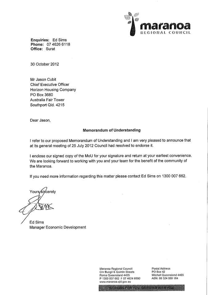

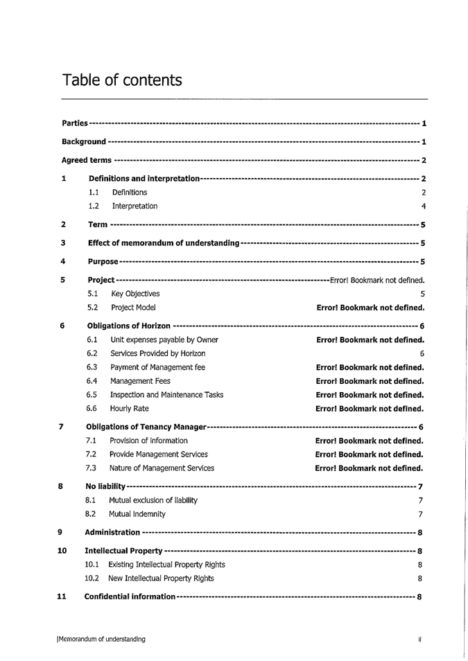
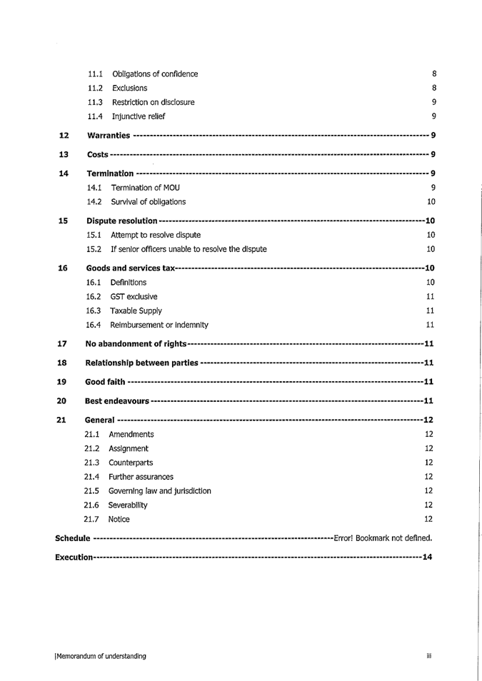
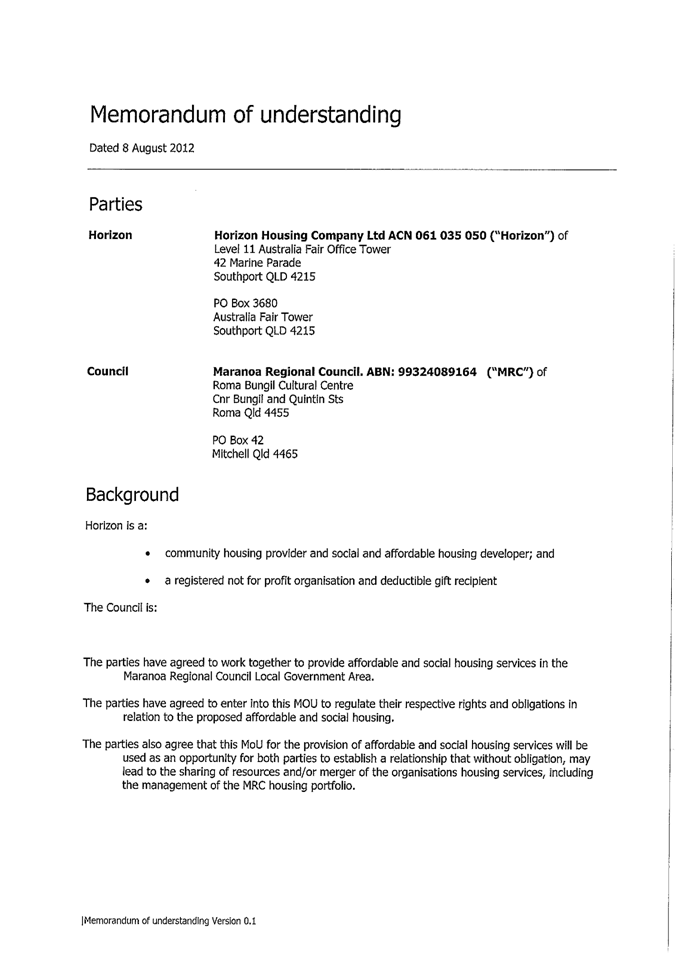
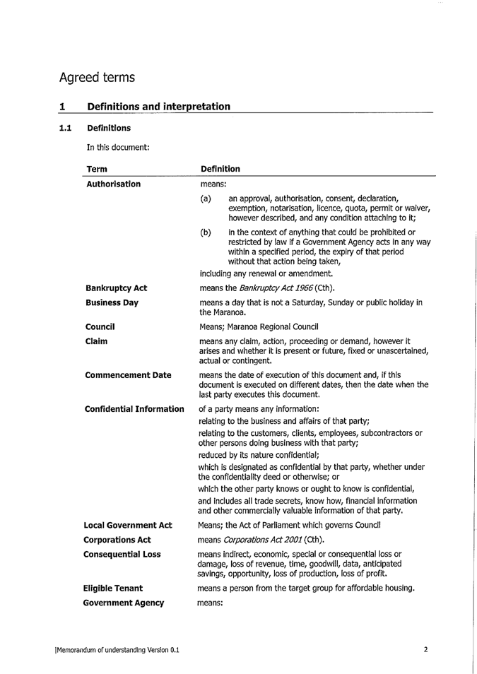
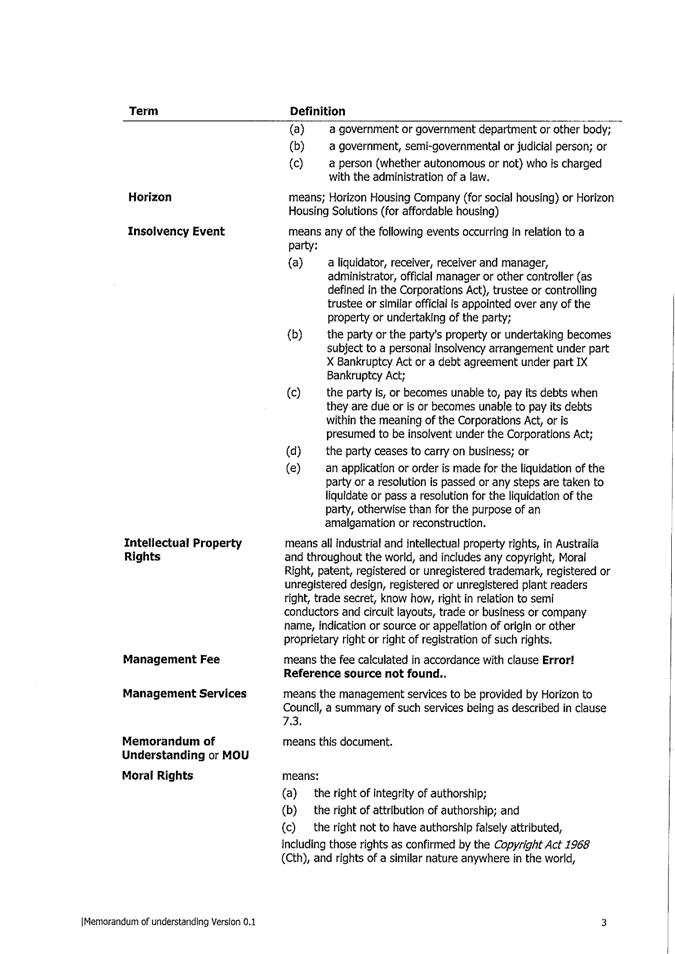
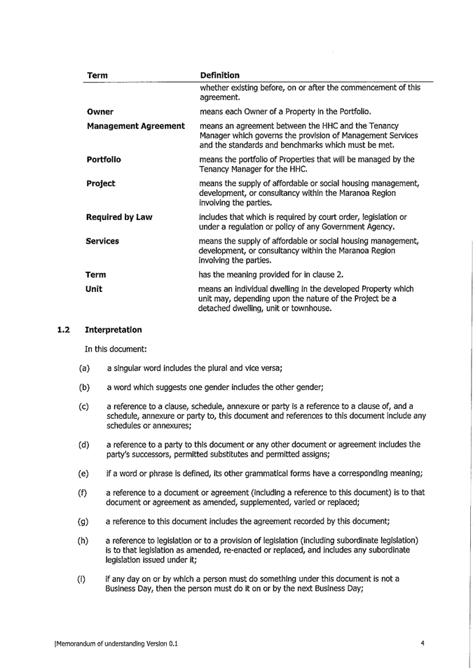
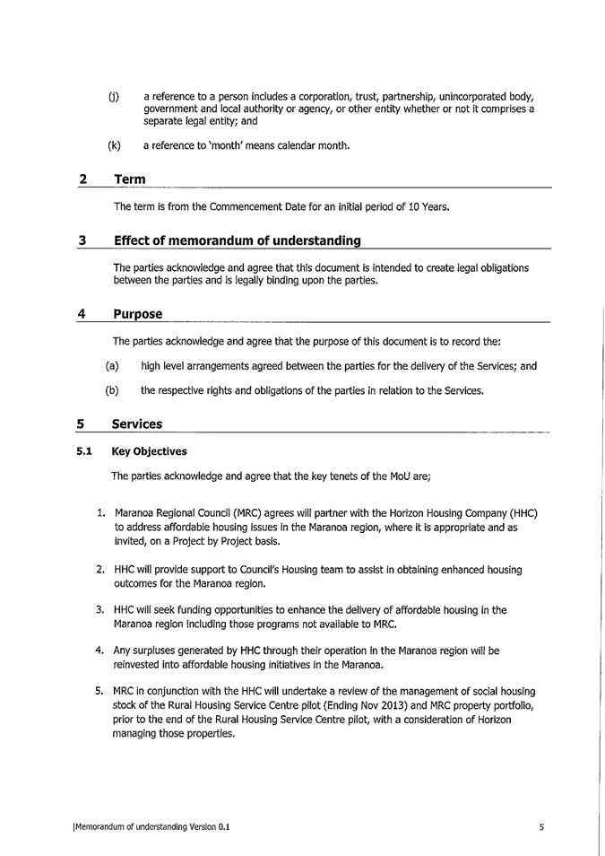
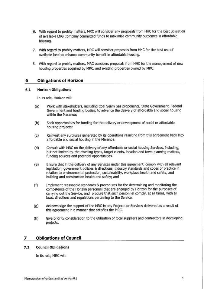
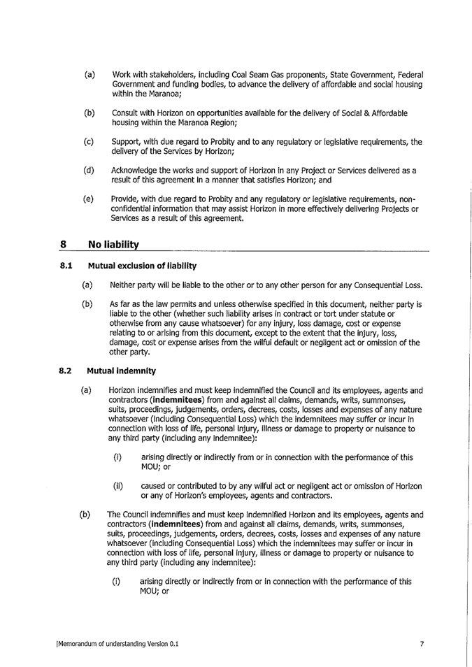
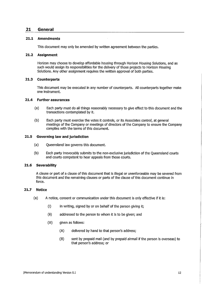
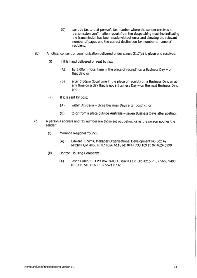
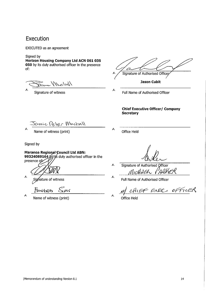

|
Attachment
2
|
Action Sheet - General Meeting - 25 July 2012 - 15.3
- Memorandum of Understanding between Council and Horizon Housing Company
|
|
For Action
|
|
General
|
25/07/2012
|
|
TO: Manager Organisational Performance (Edward Sims)
|
|
|
Subject:
|
Memorandum of Understanding
between Council and Horizon Housing Company
|
|
Target
Date:
|
10/08/2012
|
|
Notes:
|
Recommendation
approved.
|
|
File
Reference
|
SF12/5
D12/20817
|
Resolution
No. GM.202.12
Moved
Cr Newman Seconded Cr
Flynn
That Council authorises
the Acting CEO to sign off the provided Memorandum of Understanding between
Council and Horizon Housing Company.
CARRIED 9/0
This action sheet
has been automatically been produced by Executive Services using InfoCouncil,
the agenda and minutes database.
Please
complete all subsequent notes in relation to this action in InfoCouncil.
|
|
|
Attachment
3
|
Horizon Housing Company Regional Advisory Committee
- Draft Terms of Reference
|
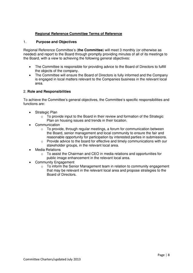
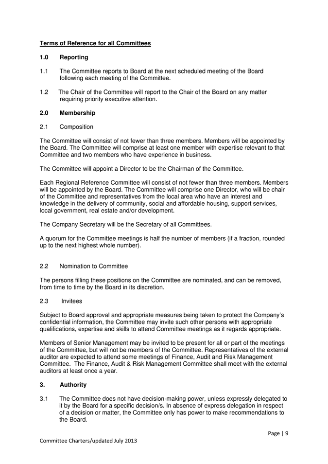
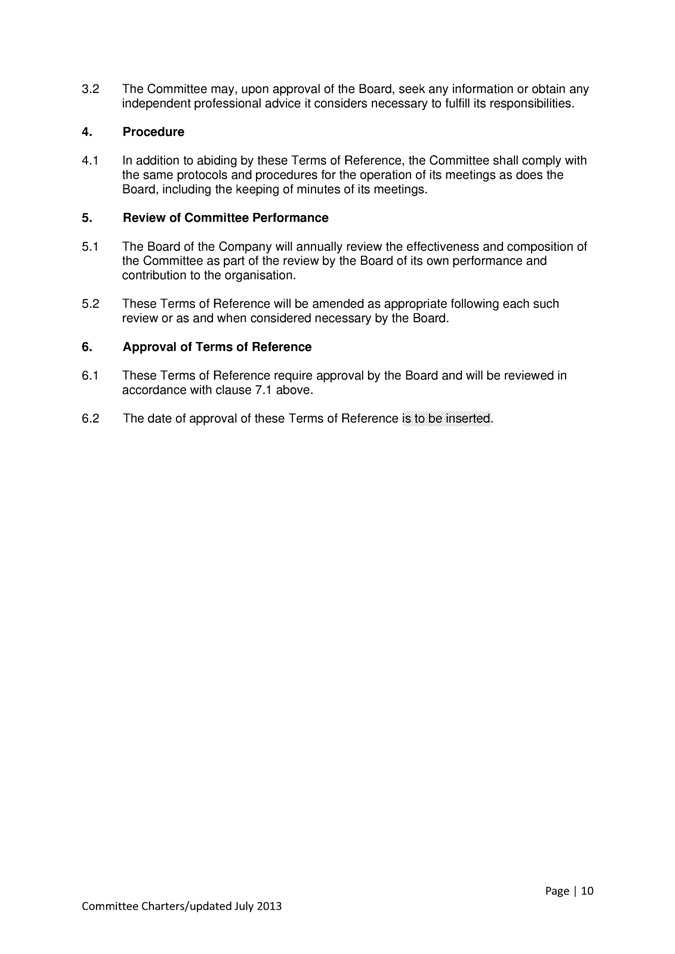
|
Attachment 1
|
Images - Toilets in Surat - Attachment 1
|
Attachment
A:
Review of and suggested improvements
to the provision of Public Toilets in Surat.
Toilets
at Shire Hall, Surat


 Toilets at Recreation
Oval,

Toilets
at Fisherman’s Park


Dump
Point, Fisherman”s Park

Surat
Weir

Barbeque
area, Surat Weir

 The end of the River Walk,
Surat Weir


